
CEH Chapel Hill, North Carolina, USA - Earthquake Result Viewer
| ||||||||||||||||||
| ||||||||||||||||||
| ||||||||||||||||||
|
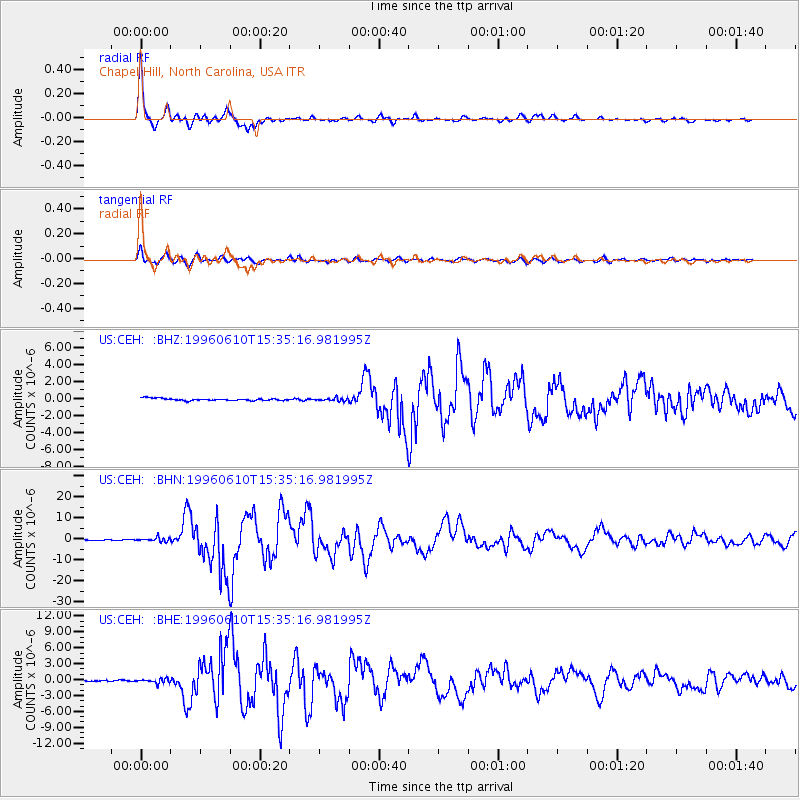
Signal To Noise
| Channel | StoN | STA | LTA |
| US:CEH: :BHN:19960610T15:35:16.981995Z | 6.229544 | 9.544971E-7 | 1.5322102E-7 |
| US:CEH: :BHE:19960610T15:35:16.981995Z | 4.880868 | 4.0015664E-7 | 8.198473E-8 |
| US:CEH: :BHZ:19960610T15:35:16.981995Z | 1.3224397 | 1.6883251E-7 | 1.2766746E-7 |
| Arrivals | |
| Ps | 4.6 SECOND |
| PpPs | 15 SECOND |
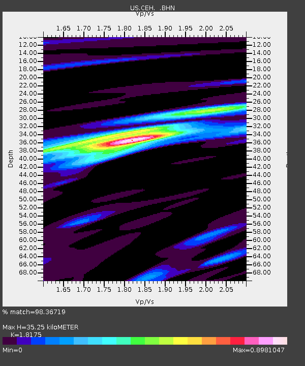
| PsPs/PpSs | 19 SECOND |

