You are here: Home > Network List > US - United States National Seismic Network Stations List
> Station CEH Chapel Hill, North Carolina, USA > Earthquake Result Viewer
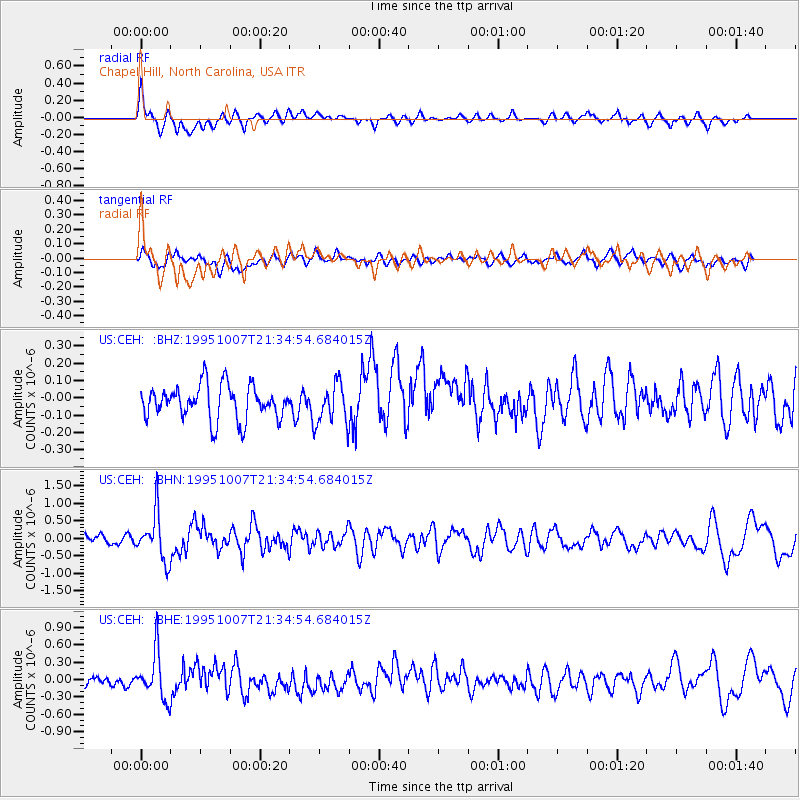
CEH Chapel Hill, North Carolina, USA - Earthquake Result Viewer
*The percent match for this event was below the threshold and hence no stack was calculated.
| Earthquake location: |
Peru-Ecuador Border Region |
| Earthquake latitude/longitude: |
-2.8/-77.8 |
| Earthquake time(UTC): |
1995/10/07 (280) 21:28:06 GMT |
| Earthquake Depth: |
33 km |
| Earthquake Magnitude: |
5.8 MB, 5.2 MS, 5.8 UNKNOWN |
| Earthquake Catalog/Contributor: |
WHDF/NEIC |
|
| Network: |
US United States National Seismic Network |
| Station: |
CEH Chapel Hill, North Carolina, USA |
| Lat/Lon: |
35.89 N/79.09 W |
| Elevation: |
152 m |
|
| Distance: |
38.5 deg |
| Az: |
358.365 deg |
| Baz: |
177.989 deg |
| Ray Param: |
$rayparam |
*The percent match for this event was below the threshold and hence was not used in the summary stack. |
|
| Radial Match: |
72.710175 % |
| Radial Bump: |
400 |
| Transverse Match: |
45.696632 % |
| Transverse Bump: |
400 |
| SOD ConfigId: |
4480 |
| Insert Time: |
2010-03-05 07:09:49.175 +0000 |
| GWidth: |
2.5 |
| Max Bumps: |
400 |
| Tol: |
0.001 |
|
Signal To Noise
| Channel | StoN | STA | LTA |
| US:CEH: :BHN:19951007T21:34:54.684015Z | 5.03331 | 6.6321644E-7 | 1.3176546E-7 |
| US:CEH: :BHE:19951007T21:34:54.684015Z | 3.3349807 | 3.9846603E-7 | 1.1948076E-7 |
| US:CEH: :BHZ:19951007T21:34:54.684015Z | 1.2039148 | 1.1840199E-7 | 9.8347485E-8 |
| Arrivals |
| Ps | |
| PpPs | |
| PsPs/PpSs | |


