You are here: Home > Network List > BK - Berkeley Digital Seismograph Network Stations List
> Station HOPS Hopland Field Station, Hopland, CA > Earthquake Result Viewer
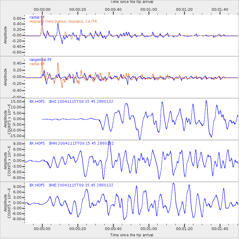
HOPS Hopland Field Station, Hopland, CA - Earthquake Result Viewer

| Earthquake location: |
Near West Coast Of Colombia |
| Earthquake latitude/longitude: |
4.7/-77.5 |
| Earthquake time(UTC): |
2004/11/15 (320) 09:06:56 GMT |
| Earthquake Depth: |
15 km |
| Earthquake Magnitude: |
6.6 MB, 7.1 MS, 7.2 MW, 7.1 MW |
| Earthquake Catalog/Contributor: |
WHDF/NEIC |
|
| Network: |
BK Berkeley Digital Seismograph Network |
| Station: |
HOPS Hopland Field Station, Hopland, CA |
| Lat/Lon: |
38.99 N/123.07 W |
| Elevation: |
299 m |
|
| Distance: |
53.5 deg |
| Az: |
316.2 deg |
| Baz: |
117.718 deg |
| Ray Param: |
0.06604127 |
| Estimated Moho Depth: |
21.75 km |
| Estimated Crust Vp/Vs: |
1.76 |
| Assumed Crust Vp: |
6.472 km/s |
| Estimated Crust Vs: |
3.677 km/s |
| Estimated Crust Poisson's Ratio: |
0.26 |
|
| Radial Match: |
90.96971 % |
| Radial Bump: |
400 |
| Transverse Match: |
86.389626 % |
| Transverse Bump: |
400 |
| SOD ConfigId: |
2459 |
| Insert Time: |
2010-03-05 19:19:17.525 +0000 |
| GWidth: |
2.5 |
| Max Bumps: |
400 |
| Tol: |
0.001 |
|
Signal To Noise
| Channel | StoN | STA | LTA |
| BK:HOPS: :BHN:20041115T09:15:45.286013Z | 3.9888232 | 1.4725222E-6 | 3.6916205E-7 |
| BK:HOPS: :BHE:20041115T09:15:45.286013Z | 5.050441 | 1.7123441E-6 | 3.3904843E-7 |
| BK:HOPS: :BHZ:20041115T09:15:45.286013Z | 15.38312 | 4.1353896E-6 | 2.6882648E-7 |
| Arrivals |
| Ps | 2.7 SECOND |
| PpPs | 8.8 SECOND |
| PsPs/PpSs | 11 SECOND |


