
HOPS Hopland Field Station, Hopland, CA - Earthquake Result Viewer
| ||||||||||||||||||
| ||||||||||||||||||
| ||||||||||||||||||
|
Signal To Noise
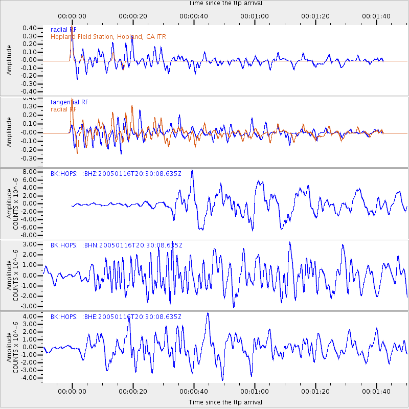
| Channel | StoN | STA | LTA |
| BK:HOPS: :BHN:20050116T20:30:08.635Z | 0.3682289 | 2.7771597E-7 | 7.5419376E-7 |
| BK:HOPS: :BHE:20050116T20:30:08.635Z | 1.3595885 | 6.461373E-7 | 4.752448E-7 |
| BK:HOPS: :BHZ:20050116T20:30:08.635Z | 5.3983707 | 1.4952237E-6 | 2.7697686E-7 |
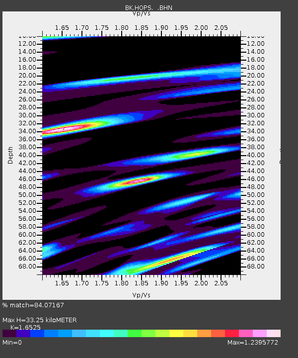
| Arrivals | |
| Ps | 3.4 SECOND |
| PpPs | 13 SECOND |
| PsPs/PpSs | 17 SECOND |

