HOPS Hopland Field Station, Hopland, CA - Earthquake Result Viewer
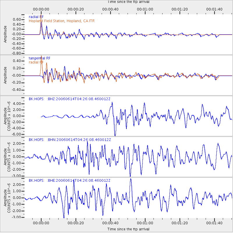
Earthquake location: Rat Islands, Aleutian Islands
Earthquake latitude/longitude: 51.8/177.1
Earthquake time(UTC): 2006/06/14 (165) 04:18:42 GMT
Earthquake Depth: 14 km
Earthquake Magnitude: 5.9 MB, 6.4 MS, 6.4 MW, 6.4 MW
Earthquake Catalog/Contributor: WHDF/NEIC
Network: BK Berkeley Digital Seismograph Network
Station: HOPS Hopland Field Station, Hopland, CA
Lat/Lon: 38.99 N/123.07 W
Elevation: 299 m
Distance: 42.8 deg
Az: 82.984 deg
Baz: 307.653 deg
Ray Param: 0.07297329
Estimated Moho Depth: 18.25 km
Estimated Crust Vp/Vs: 2.07
Assumed Crust Vp: 6.472 km/s
Estimated Crust Vs: 3.127 km/s
Estimated Crust Poisson's Ratio: 0.35
Radial Match: 86.970184 %
Radial Bump: 400
Transverse Match: 73.68086 %
Transverse Bump: 400
SOD ConfigId: 5745
Insert Time: 2010-03-05 19:20:15.732 +0000
GWidth: 2.5
Max Bumps: 400
Tol: 0.001

Signal To Noise

ChannelStoNSTALTA
BK:HOPS: :BHN:20060614T04:26:08.460012Z1.1429812.819939E-72.4671792E-7
BK:HOPS: :BHE:20060614T04:26:08.460012Z1.89056093.4389902E-71.8190316E-7
BK:HOPS: :BHZ:20060614T04:26:08.460012Z3.17130428.1472115E-72.5690412E-7
Arrivals
Ps3.2 SECOND
PpPs8.2 SECOND
PsPs/PpSs11 SECOND