You are here: Home > Network List > NM - Cooperative New Madrid Seismic Network Stations List
> Station HDBT Mud Island,Memphis,TN(CERI) > Earthquake Result Viewer
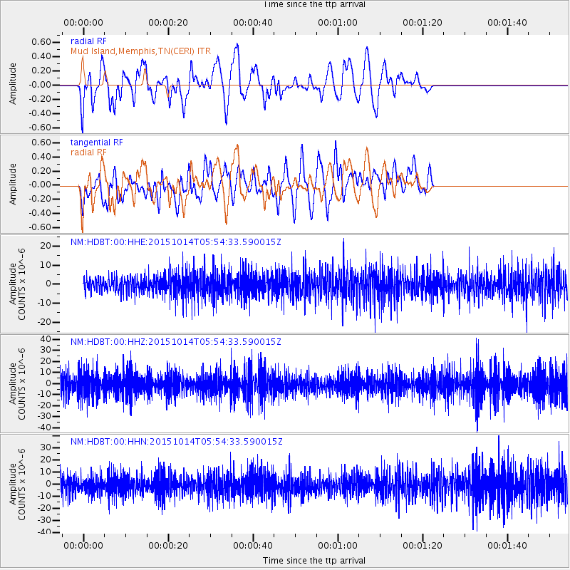
HDBT Mud Island,Memphis,TN(CERI) - Earthquake Result Viewer
*The percent match for this event was below the threshold and hence no stack was calculated.
| Earthquake location: |
East Of Kuril Islands |
| Earthquake latitude/longitude: |
48.9/156.2 |
| Earthquake time(UTC): |
2015/10/14 (287) 05:43:07 GMT |
| Earthquake Depth: |
6.0 km |
| Earthquake Magnitude: |
5.6 MB, 5.9 MWB |
| Earthquake Catalog/Contributor: |
NEIC PDE/NEIC COMCAT |
|
| Network: |
NM Cooperative New Madrid Seismic Network |
| Station: |
HDBT Mud Island,Memphis,TN(CERI) |
| Lat/Lon: |
35.15 N/90.06 W |
| Elevation: |
66 m |
|
| Distance: |
77.7 deg |
| Az: |
50.17 deg |
| Baz: |
321.755 deg |
| Ray Param: |
$rayparam |
*The percent match for this event was below the threshold and hence was not used in the summary stack. |
|
| Radial Match: |
63.14072 % |
| Radial Bump: |
400 |
| Transverse Match: |
63.32297 % |
| Transverse Bump: |
400 |
| SOD ConfigId: |
1259291 |
| Insert Time: |
2015-10-28 06:52:44.031 +0000 |
| GWidth: |
2.5 |
| Max Bumps: |
400 |
| Tol: |
0.001 |
|
Signal To Noise
| Channel | StoN | STA | LTA |
| NM:HDBT:00:HHZ:20151014T05:54:33.590015Z | 1.6531793 | 1.1318388E-5 | 6.846437E-6 |
| NM:HDBT:00:HHN:20151014T05:54:33.590015Z | 0.9920836 | 6.5837585E-6 | 6.6362936E-6 |
| NM:HDBT:00:HHE:20151014T05:54:33.590015Z | 1.3896518 | 6.347728E-6 | 4.567855E-6 |
| Arrivals |
| Ps | |
| PpPs | |
| PsPs/PpSs | |


