You are here: Home > Network List > IC - New China Digital Seismograph Network Stations List
> Station HIA Hailar, Neimenggu Autonomous Region, China > Earthquake Result Viewer
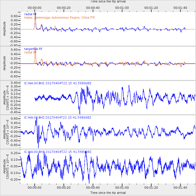
HIA Hailar, Neimenggu Autonomous Region, China - Earthquake Result Viewer
*The percent match for this event was below the threshold and hence no stack was calculated.
| Earthquake location: |
Andreanof Islands, Aleutian Is. |
| Earthquake latitude/longitude: |
51.3/-176.4 |
| Earthquake time(UTC): |
2017/04/04 (094) 22:08:40 GMT |
| Earthquake Depth: |
13 km |
| Earthquake Magnitude: |
5.5 Mww |
| Earthquake Catalog/Contributor: |
NEIC PDE/us |
|
| Network: |
IC New China Digital Seismograph Network |
| Station: |
HIA Hailar, Neimenggu Autonomous Region, China |
| Lat/Lon: |
49.27 N/119.74 E |
| Elevation: |
620 m |
|
| Distance: |
39.7 deg |
| Az: |
293.028 deg |
| Baz: |
61.967 deg |
| Ray Param: |
$rayparam |
*The percent match for this event was below the threshold and hence was not used in the summary stack. |
|
| Radial Match: |
76.32366 % |
| Radial Bump: |
358 |
| Transverse Match: |
47.905235 % |
| Transverse Bump: |
400 |
| SOD ConfigId: |
11737051 |
| Insert Time: |
2019-04-27 01:12:07.551 +0000 |
| GWidth: |
2.5 |
| Max Bumps: |
400 |
| Tol: |
0.001 |
|
Signal To Noise
| Channel | StoN | STA | LTA |
| IC:HIA:00:BHZ:20170404T22:15:41.568998Z | 5.995911 | 3.20909E-7 | 5.3521312E-8 |
| IC:HIA:00:BH1:20170404T22:15:41.568998Z | 1.2059438 | 7.86299E-8 | 6.520196E-8 |
| IC:HIA:00:BH2:20170404T22:15:41.568998Z | 4.8932314 | 1.9263364E-7 | 3.9367368E-8 |
| Arrivals |
| Ps | |
| PpPs | |
| PsPs/PpSs | |


