
D05A Enumclaw, WA, USA - Earthquake Result Viewer
| ||||||||||||||||||
| ||||||||||||||||||
| ||||||||||||||||||
|
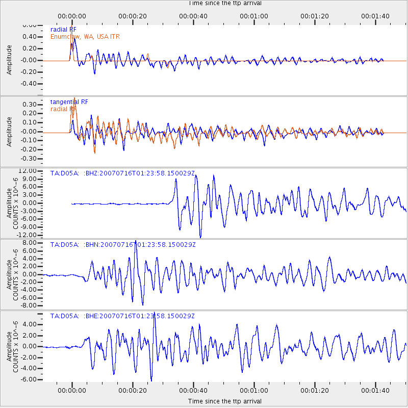
Signal To Noise
| Channel | StoN | STA | LTA |
| TA:D05A: :BHN:20070716T01:23:58.150029Z | 5.398106 | 5.8946847E-7 | 1.0919912E-7 |
| TA:D05A: :BHE:20070716T01:23:58.150029Z | 6.619027 | 5.463166E-7 | 8.253729E-8 |
| TA:D05A: :BHZ:20070716T01:23:58.150029Z | 31.64917 | 3.124206E-6 | 9.8713684E-8 |
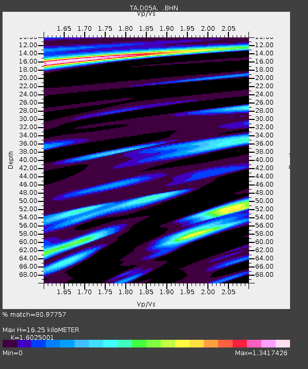
| Arrivals | |
| Ps | 1.6 SECOND |
| PpPs | 6.1 SECOND |
| PsPs/PpSs | 7.7 SECOND |

