
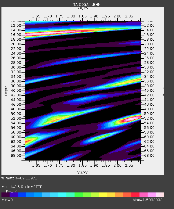
D05A Enumclaw, WA, USA - Earthquake Result Viewer
| ||||||||||||||||||
| ||||||||||||||||||
| ||||||||||||||||||
|
Signal To Noise
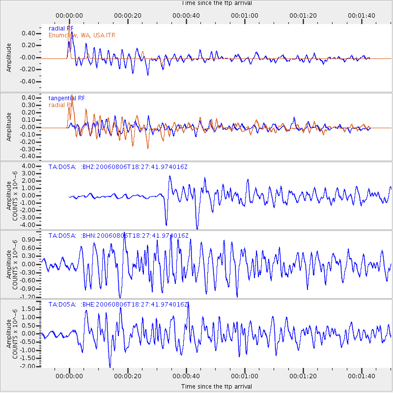
| Channel | StoN | STA | LTA |
| TA:D05A: :BHN:20060806T18:27:41.974016Z | 1.946968 | 2.7726549E-7 | 1.4240887E-7 |
| TA:D05A: :BHE:20060806T18:27:41.974016Z | 2.3963318 | 4.4421375E-7 | 1.8537239E-7 |
| TA:D05A: :BHZ:20060806T18:27:41.974016Z | 9.525961 | 1.5760556E-6 | 1.6544847E-7 |
| Arrivals | |
| Ps | 1.7 SECOND |
| PpPs | 5.9 SECOND |
| PsPs/PpSs | 7.6 SECOND |

