D05A Enumclaw, WA, USA - Earthquake Result Viewer
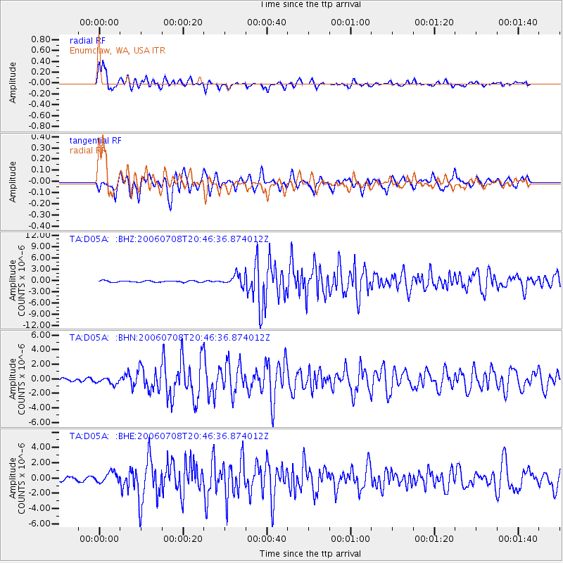
Earthquake location: Andreanof Islands, Aleutian Is.
Earthquake latitude/longitude: 51.2/-179.3
Earthquake time(UTC): 2006/07/08 (189) 20:40:00 GMT
Earthquake Depth: 22 km
Earthquake Magnitude: 6.2 MB, 6.4 MS, 6.6 MW, 6.6 MW
Earthquake Catalog/Contributor: WHDF/NEIC
Network: TA USArray Transportable Network (new EarthScope stations)
Station: D05A Enumclaw, WA, USA
Lat/Lon: 47.19 N/121.99 W
Elevation: 266 m
Distance: 36.9 deg
Az: 73.167 deg
Baz: 298.034 deg
Ray Param: 0.076423205
Estimated Moho Depth: 57.25 km
Estimated Crust Vp/Vs: 1.74
Assumed Crust Vp: 6.597 km/s
Estimated Crust Vs: 3.803 km/s
Estimated Crust Poisson's Ratio: 0.25
Radial Match: 91.12294 %
Radial Bump: 365
Transverse Match: 70.27532 %
Transverse Bump: 400
SOD ConfigId: 2665
Insert Time: 2010-03-06 02:59:35.634 +0000
GWidth: 2.5
Max Bumps: 400
Tol: 0.001

Signal To Noise

ChannelStoNSTALTA
TA:D05A: :BHN:20060708T20:46:36.874012Z2.0025194.514682E-72.2545015E-7
TA:D05A: :BHE:20060708T20:46:36.874012Z2.69055066.9198404E-72.571905E-7
TA:D05A: :BHZ:20060708T20:46:36.874012Z7.2695671.4678867E-62.0192215E-7
Arrivals
Ps6.9 SECOND
PpPs22 SECOND
PsPs/PpSs29 SECOND