
D05A Enumclaw, WA, USA - Earthquake Result Viewer
| ||||||||||||||||||
| ||||||||||||||||||
| ||||||||||||||||||
|
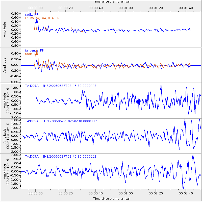
Signal To Noise
| Channel | StoN | STA | LTA |
| TA:D05A: :BHN:20060627T02:46:30.000011Z | 1.8799247 | 3.3863373E-7 | 1.8013155E-7 |
| TA:D05A: :BHE:20060627T02:46:30.000011Z | 1.4470373 | 4.1915345E-7 | 2.896632E-7 |
| TA:D05A: :BHZ:20060627T02:46:30.000011Z | 3.7859027 | 7.0665067E-7 | 1.8665314E-7 |
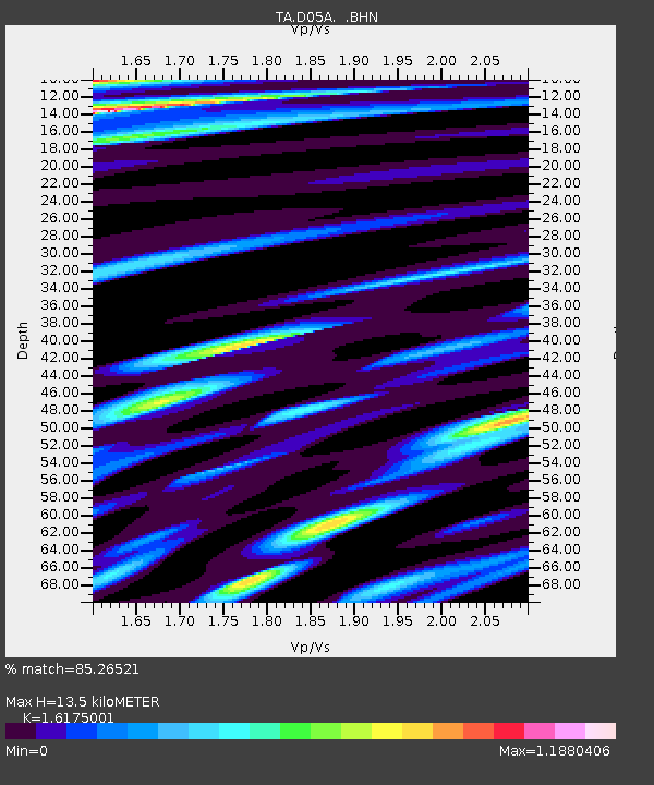
| Arrivals | |
| Ps | 1.4 SECOND |
| PpPs | 4.9 SECOND |
| PsPs/PpSs | 6.3 SECOND |

