You are here: Home > Network List > GS - US Geological Survey Networks Stations List
> Station OK042 N2343 and E0420 Rds, Waynoka, OK, USA > Earthquake Result Viewer
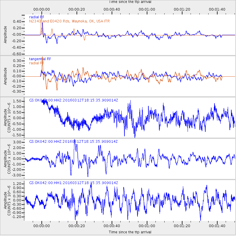
OK042 N2343 and E0420 Rds, Waynoka, OK, USA - Earthquake Result Viewer
*The percent match for this event was below the threshold and hence no stack was calculated.
| Earthquake location: |
Andreanof Islands, Aleutian Is. |
| Earthquake latitude/longitude: |
51.6/-174.0 |
| Earthquake time(UTC): |
2016/03/12 (072) 18:06:45 GMT |
| Earthquake Depth: |
19 km |
| Earthquake Magnitude: |
6.3 MWW, 6.1 MB, 6.2 MWB, 6.3 MWC, 6.4 MWC, 6.4 MI |
| Earthquake Catalog/Contributor: |
NEIC PDE/NEIC COMCAT |
|
| Network: |
GS US Geological Survey Networks |
| Station: |
OK042 N2343 and E0420 Rds, Waynoka, OK, USA |
| Lat/Lon: |
36.40 N/98.83 W |
| Elevation: |
442 m |
|
| Distance: |
53.8 deg |
| Az: |
75.082 deg |
| Baz: |
311.61 deg |
| Ray Param: |
$rayparam |
*The percent match for this event was below the threshold and hence was not used in the summary stack. |
|
| Radial Match: |
64.33452 % |
| Radial Bump: |
400 |
| Transverse Match: |
44.775227 % |
| Transverse Bump: |
400 |
| SOD ConfigId: |
1453031 |
| Insert Time: |
2016-03-26 18:26:37.464 +0000 |
| GWidth: |
2.5 |
| Max Bumps: |
400 |
| Tol: |
0.001 |
|
Signal To Noise
| Channel | StoN | STA | LTA |
| GS:OK042:00:HHZ:20160312T18:15:35.909014Z | 2.5210185 | 4.4595544E-7 | 1.7689496E-7 |
| GS:OK042:00:HH1:20160312T18:15:35.909014Z | 1.0701998 | 3.20337E-7 | 2.9932445E-7 |
| GS:OK042:00:HH2:20160312T18:15:35.909014Z | 0.38563818 | 2.8590878E-7 | 7.4139126E-7 |
| Arrivals |
| Ps | |
| PpPs | |
| PsPs/PpSs | |


