You are here: Home > Network List > GS - US Geological Survey Networks Stations List
> Station OK042 N2343 and E0420 Rds, Waynoka, OK, USA > Earthquake Result Viewer
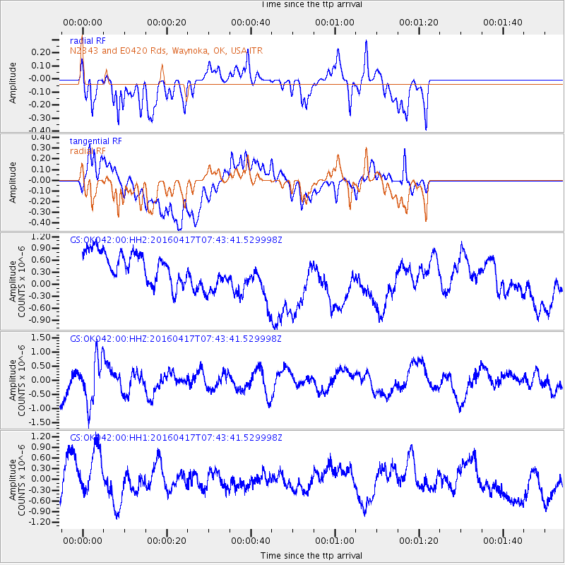
OK042 N2343 and E0420 Rds, Waynoka, OK, USA - Earthquake Result Viewer
*The percent match for this event was below the threshold and hence no stack was calculated.
| Earthquake location: |
Tonga Islands Region |
| Earthquake latitude/longitude: |
-23.6/-174.3 |
| Earthquake time(UTC): |
2016/04/17 (108) 07:31:03 GMT |
| Earthquake Depth: |
35 km |
| Earthquake Magnitude: |
5.8 MB |
| Earthquake Catalog/Contributor: |
NEIC PDE/NEIC COMCAT |
|
| Network: |
GS US Geological Survey Networks |
| Station: |
OK042 N2343 and E0420 Rds, Waynoka, OK, USA |
| Lat/Lon: |
36.40 N/98.83 W |
| Elevation: |
442 m |
|
| Distance: |
92.9 deg |
| Az: |
51.445 deg |
| Baz: |
242.774 deg |
| Ray Param: |
$rayparam |
*The percent match for this event was below the threshold and hence was not used in the summary stack. |
|
| Radial Match: |
49.78306 % |
| Radial Bump: |
400 |
| Transverse Match: |
46.988914 % |
| Transverse Bump: |
400 |
| SOD ConfigId: |
1475611 |
| Insert Time: |
2016-05-01 07:36:51.047 +0000 |
| GWidth: |
2.5 |
| Max Bumps: |
400 |
| Tol: |
0.001 |
|
Signal To Noise
| Channel | StoN | STA | LTA |
| GS:OK042:00:HHZ:20160417T07:43:41.529998Z | 1.5294658 | 7.7718954E-7 | 5.081444E-7 |
| GS:OK042:00:HH1:20160417T07:43:41.529998Z | 1.4850358 | 8.770329E-7 | 5.905803E-7 |
| GS:OK042:00:HH2:20160417T07:43:41.529998Z | 1.4757582 | 5.558196E-7 | 3.7663324E-7 |
| Arrivals |
| Ps | |
| PpPs | |
| PsPs/PpSs | |


