You are here: Home > Network List > GS - US Geological Survey Networks Stations List
> Station OK041 County Line and E0380 Rds, Cleo Springs, OK, USA > Earthquake Result Viewer
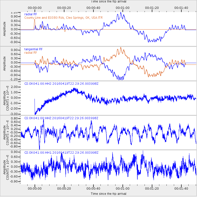
OK041 County Line and E0380 Rds, Cleo Springs, OK, USA - Earthquake Result Viewer
*The percent match for this event was below the threshold and hence no stack was calculated.
| Earthquake location: |
Near Coast Of Ecuador |
| Earthquake latitude/longitude: |
0.6/-80.1 |
| Earthquake time(UTC): |
2016/04/19 (110) 22:22:26 GMT |
| Earthquake Depth: |
15 km |
| Earthquake Magnitude: |
5.5 MB |
| Earthquake Catalog/Contributor: |
NEIC PDE/NEIC ALERT |
|
| Network: |
GS US Geological Survey Networks |
| Station: |
OK041 County Line and E0380 Rds, Cleo Springs, OK, USA |
| Lat/Lon: |
36.47 N/98.53 W |
| Elevation: |
445 m |
|
| Distance: |
39.6 deg |
| Az: |
336.384 deg |
| Baz: |
150.202 deg |
| Ray Param: |
$rayparam |
*The percent match for this event was below the threshold and hence was not used in the summary stack. |
|
| Radial Match: |
45.33627 % |
| Radial Bump: |
400 |
| Transverse Match: |
38.10824 % |
| Transverse Bump: |
400 |
| SOD ConfigId: |
1475611 |
| Insert Time: |
2016-05-03 22:28:54.686 +0000 |
| GWidth: |
2.5 |
| Max Bumps: |
400 |
| Tol: |
0.001 |
|
Signal To Noise
| Channel | StoN | STA | LTA |
| GS:OK041:00:HHZ:20160419T22:29:26.003998Z | 2.7084956 | 3.1933067E-7 | 1.1789964E-7 |
| GS:OK041:00:HH1:20160419T22:29:26.003998Z | 1.6835014 | 3.8468602E-7 | 2.2850354E-7 |
| GS:OK041:00:HH2:20160419T22:29:26.003998Z | 1.1862206 | 1.4006795E-6 | 1.1807916E-6 |
| Arrivals |
| Ps | |
| PpPs | |
| PsPs/PpSs | |


