You are here: Home > Network List > IC - New China Digital Seismograph Network Stations List
> Station HIA Hailar, Neimenggu Autonomous Region, China > Earthquake Result Viewer
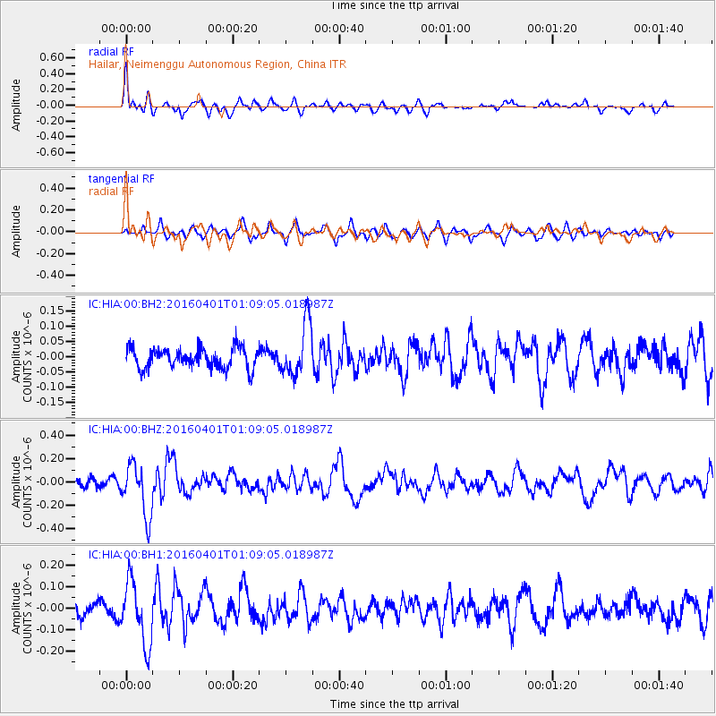
HIA Hailar, Neimenggu Autonomous Region, China - Earthquake Result Viewer
*The percent match for this event was below the threshold and hence no stack was calculated.
| Earthquake location: |
South Of Mariana Islands |
| Earthquake latitude/longitude: |
12.0/143.8 |
| Earthquake time(UTC): |
2016/04/01 (092) 01:01:43 GMT |
| Earthquake Depth: |
10 km |
| Earthquake Magnitude: |
5.5 MB |
| Earthquake Catalog/Contributor: |
NEIC PDE/NEIC COMCAT |
|
| Network: |
IC New China Digital Seismograph Network |
| Station: |
HIA Hailar, Neimenggu Autonomous Region, China |
| Lat/Lon: |
49.27 N/119.74 E |
| Elevation: |
620 m |
|
| Distance: |
42.2 deg |
| Az: |
336.545 deg |
| Baz: |
143.516 deg |
| Ray Param: |
$rayparam |
*The percent match for this event was below the threshold and hence was not used in the summary stack. |
|
| Radial Match: |
59.323242 % |
| Radial Bump: |
400 |
| Transverse Match: |
60.545094 % |
| Transverse Bump: |
400 |
| SOD ConfigId: |
1609551 |
| Insert Time: |
2016-06-22 14:36:10.462 +0000 |
| GWidth: |
2.5 |
| Max Bumps: |
400 |
| Tol: |
0.001 |
|
Signal To Noise
| Channel | StoN | STA | LTA |
| IC:HIA:00:BHZ:20160401T01:09:05.018987Z | 3.846062 | 2.2594692E-7 | 5.8747602E-8 |
| IC:HIA:00:BH1:20160401T01:09:05.018987Z | 4.331857 | 1.497964E-7 | 3.4580182E-8 |
| IC:HIA:00:BH2:20160401T01:09:05.018987Z | 2.7218342 | 8.846533E-8 | 3.25021E-8 |
| Arrivals |
| Ps | |
| PpPs | |
| PsPs/PpSs | |


