You are here: Home > Network List > IC - New China Digital Seismograph Network Stations List
> Station HIA Hailar, Neimenggu Autonomous Region, China > Earthquake Result Viewer
HIA Hailar, Neimenggu Autonomous Region, China - Earthquake Result Viewer
*The percent match for this event was below the threshold and hence no stack was calculated.
| Earthquake location: |
Flores Sea |
| Earthquake latitude/longitude: |
-7.2/122.5 |
| Earthquake time(UTC): |
2016/08/23 (236) 19:40:46 GMT |
| Earthquake Depth: |
514 km |
| Earthquake Magnitude: |
5.8 MB |
| Earthquake Catalog/Contributor: |
NEIC PDE/NEIC ALERT |
|
| Network: |
IC New China Digital Seismograph Network |
| Station: |
HIA Hailar, Neimenggu Autonomous Region, China |
| Lat/Lon: |
49.27 N/119.74 E |
| Elevation: |
620 m |
|
| Distance: |
56.3 deg |
| Az: |
357.796 deg |
| Baz: |
176.66 deg |
| Ray Param: |
$rayparam |
*The percent match for this event was below the threshold and hence was not used in the summary stack. |
|
| Radial Match: |
79.59619 % |
| Radial Bump: |
400 |
| Transverse Match: |
72.42684 % |
| Transverse Bump: |
400 |
| SOD ConfigId: |
1634031 |
| Insert Time: |
2016-09-06 19:44:09.557 +0000 |
| GWidth: |
2.5 |
| Max Bumps: |
400 |
| Tol: |
0.001 |
|
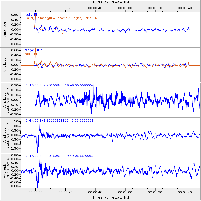
Signal To Noise
| Channel | StoN | STA | LTA |
| IC:HIA:00:BHZ:20160823T19:49:06.669006Z | 5.1689634 | 6.4345016E-7 | 1.2448339E-7 |
| IC:HIA:00:BH1:20160823T19:49:06.669006Z | 3.9092026 | 3.6319815E-7 | 9.29085E-8 |
| IC:HIA:00:BH2:20160823T19:49:06.669006Z | 1.0675608 | 7.1444326E-8 | 6.692296E-8 |
| Arrivals |
| Ps | |
| PpPs | |
| PsPs/PpSs | |


