You are here: Home > Network List > GS - US Geological Survey Networks Stations List
> Station OK046 Pawnee, OK, Station 46 > Earthquake Result Viewer
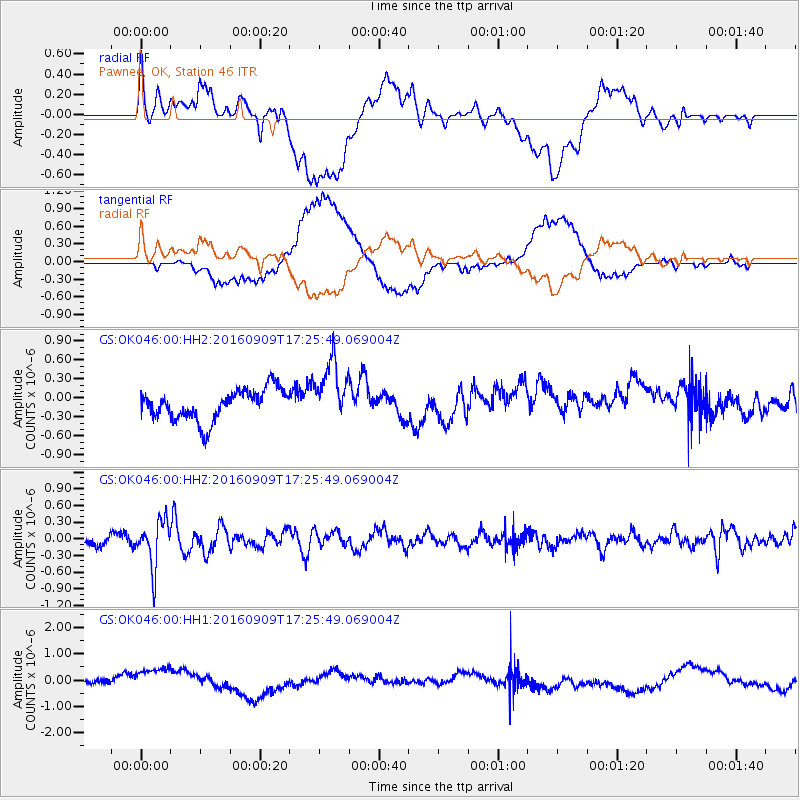
OK046 Pawnee, OK, Station 46 - Earthquake Result Viewer
*The percent match for this event was below the threshold and hence no stack was calculated.
| Earthquake location: |
Northern Mid-Atlantic Ridge |
| Earthquake latitude/longitude: |
22.1/-45.9 |
| Earthquake time(UTC): |
2016/09/09 (253) 17:17:54 GMT |
| Earthquake Depth: |
10 km |
| Earthquake Magnitude: |
5.5 MB |
| Earthquake Catalog/Contributor: |
NEIC PDE/NEIC COMCAT |
|
| Network: |
GS US Geological Survey Networks |
| Station: |
OK046 Pawnee, OK, Station 46 |
| Lat/Lon: |
36.40 N/96.91 W |
| Elevation: |
294 m |
|
| Distance: |
46.3 deg |
| Az: |
299.711 deg |
| Baz: |
93.371 deg |
| Ray Param: |
$rayparam |
*The percent match for this event was below the threshold and hence was not used in the summary stack. |
|
| Radial Match: |
50.743732 % |
| Radial Bump: |
400 |
| Transverse Match: |
46.642185 % |
| Transverse Bump: |
400 |
| SOD ConfigId: |
1634031 |
| Insert Time: |
2016-09-23 17:20:51.551 +0000 |
| GWidth: |
2.5 |
| Max Bumps: |
400 |
| Tol: |
0.001 |
|
Signal To Noise
| Channel | StoN | STA | LTA |
| GS:OK046:00:HHZ:20160909T17:25:49.069004Z | 4.053372 | 4.1930969E-7 | 1.0344713E-7 |
| GS:OK046:00:HH1:20160909T17:25:49.069004Z | 3.170768 | 5.5823745E-7 | 1.7605748E-7 |
| GS:OK046:00:HH2:20160909T17:25:49.069004Z | 1.9507481 | 4.7341942E-7 | 2.426861E-7 |
| Arrivals |
| Ps | |
| PpPs | |
| PsPs/PpSs | |


