You are here: Home > Network List > GS - US Geological Survey Networks Stations List
> Station OK046 Pawnee, OK, Station 46 > Earthquake Result Viewer
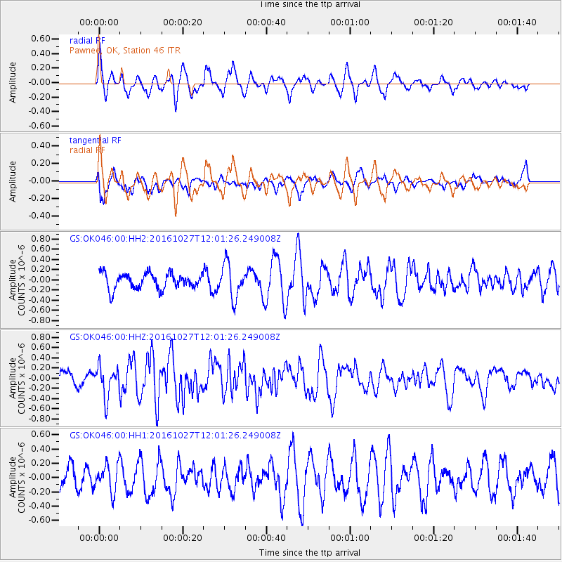
OK046 Pawnee, OK, Station 46 - Earthquake Result Viewer
*The percent match for this event was below the threshold and hence no stack was calculated.
| Earthquake location: |
Unimak Island Region, Alaska |
| Earthquake latitude/longitude: |
53.6/-163.3 |
| Earthquake time(UTC): |
2016/10/27 (301) 11:53:18 GMT |
| Earthquake Depth: |
17 km |
| Earthquake Magnitude: |
5.8 MWP, 5.8 MI |
| Earthquake Catalog/Contributor: |
NEIC PDE/NEIC COMCAT |
|
| Network: |
GS US Geological Survey Networks |
| Station: |
OK046 Pawnee, OK, Station 46 |
| Lat/Lon: |
36.40 N/96.91 W |
| Elevation: |
294 m |
|
| Distance: |
48.1 deg |
| Az: |
82.894 deg |
| Baz: |
312.893 deg |
| Ray Param: |
$rayparam |
*The percent match for this event was below the threshold and hence was not used in the summary stack. |
|
| Radial Match: |
76.07992 % |
| Radial Bump: |
400 |
| Transverse Match: |
59.029087 % |
| Transverse Bump: |
400 |
| SOD ConfigId: |
1815711 |
| Insert Time: |
2016-11-10 11:56:34.227 +0000 |
| GWidth: |
2.5 |
| Max Bumps: |
400 |
| Tol: |
0.001 |
|
Signal To Noise
| Channel | StoN | STA | LTA |
| GS:OK046:00:HHZ:20161027T12:01:26.249008Z | 1.9212625 | 3.0542094E-7 | 1.5896889E-7 |
| GS:OK046:00:HH1:20161027T12:01:26.249008Z | 0.9323251 | 1.9276773E-7 | 2.0676019E-7 |
| GS:OK046:00:HH2:20161027T12:01:26.249008Z | 2.2983751 | 3.4948695E-7 | 1.5205828E-7 |
| Arrivals |
| Ps | |
| PpPs | |
| PsPs/PpSs | |


