W12A Cal Nev Ari, NV, USA - Earthquake Result Viewer
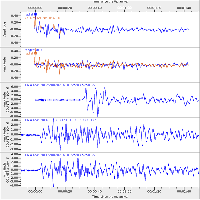
Earthquake location: Near West Coast Of Honshu, Japan
Earthquake latitude/longitude: 37.5/138.4
Earthquake time(UTC): 2007/07/16 (197) 01:13:22 GMT
Earthquake Depth: 12 km
Earthquake Magnitude: 6.5 MB, 6.4 MS, 6.6 MW, 6.5 MW
Earthquake Catalog/Contributor: WHDF/NEIC
Network: TA USArray Transportable Network (new EarthScope stations)
Station: W12A Cal Nev Ari, NV, USA
Lat/Lon: 35.30 N/114.87 W
Elevation: 774 m
Distance: 80.7 deg
Az: 52.566 deg
Baz: 309.491 deg
Ray Param: 0.048123654
Estimated Moho Depth: 14.5 km
Estimated Crust Vp/Vs: 2.10
Assumed Crust Vp: 6.276 km/s
Estimated Crust Vs: 2.992 km/s
Estimated Crust Poisson's Ratio: 0.35
Radial Match: 93.27289 %
Radial Bump: 400
Transverse Match: 85.59831 %
Transverse Bump: 400
SOD ConfigId: 2564
Insert Time: 2010-03-06 22:13:25.302 +0000
GWidth: 2.5
Max Bumps: 400
Tol: 0.001

Signal To Noise

ChannelStoNSTALTA
TA:W12A: :BHN:20070716T01:25:03.575017Z7.48049645.307138E-77.0946335E-8
TA:W12A: :BHE:20070716T01:25:03.575017Z6.29532535.594077E-78.886081E-8
TA:W12A: :BHZ:20070716T01:25:03.575017Z22.2558542.0708765E-69.304863E-8
Arrivals
Ps2.6 SECOND
PpPs7.0 SECOND
PsPs/PpSs9.6 SECOND