
W12A Cal Nev Ari, NV, USA - Earthquake Result Viewer
| ||||||||||||||||||
| ||||||||||||||||||
| ||||||||||||||||||
|
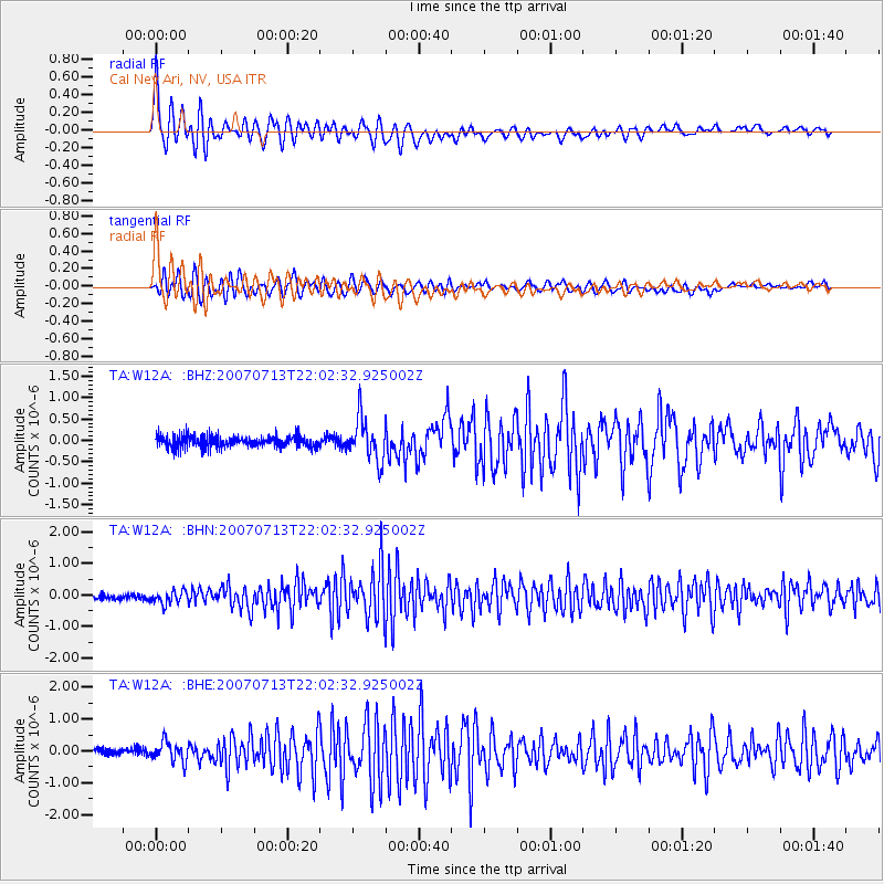
Signal To Noise
| Channel | StoN | STA | LTA |
| TA:W12A: :BHN:20070713T22:02:32.925002Z | 2.423746 | 2.1150827E-7 | 8.726503E-8 |
| TA:W12A: :BHE:20070713T22:02:32.925002Z | 2.3218112 | 3.085136E-7 | 1.3287625E-7 |
| TA:W12A: :BHZ:20070713T22:02:32.925002Z | 3.6379468 | 4.972823E-7 | 1.3669313E-7 |
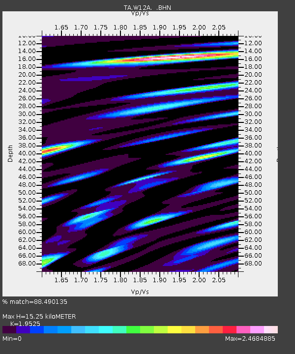
| Arrivals | |
| Ps | 2.4 SECOND |
| PpPs | 6.8 SECOND |
| PsPs/PpSs | 9.2 SECOND |

