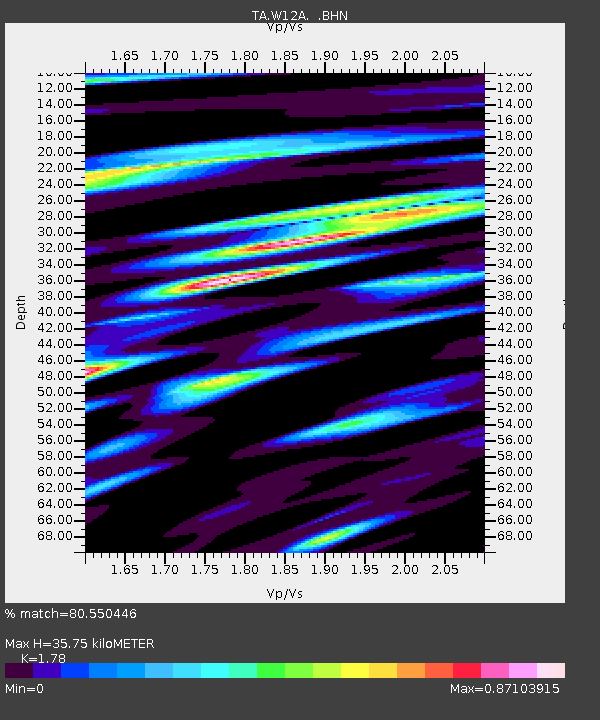
W12A Cal Nev Ari, NV, USA - Earthquake Result Viewer
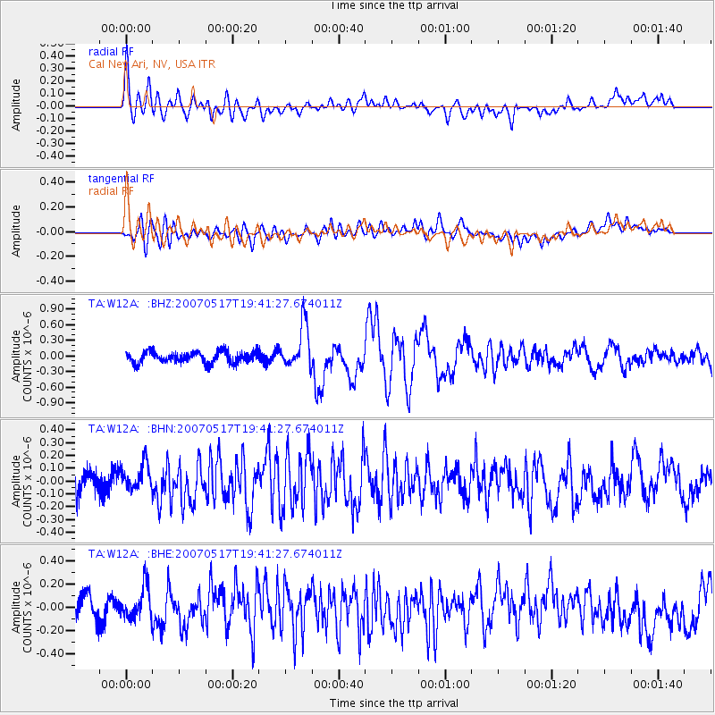
Earthquake location: Kermadec Islands, New Zealand
Earthquake latitude/longitude: -30.7/-178.2
Earthquake time(UTC): 2007/05/17 (137) 19:29:10 GMT
Earthquake Depth: 41 km
Earthquake Magnitude: 5.5 MB, 5.6 MS, 6.0 MW, 5.9 MW
Earthquake Catalog/Contributor: WHDF/NEIC
Network: TA USArray Transportable Network (new EarthScope stations)
Station: W12A Cal Nev Ari, NV, USA
Lat/Lon: 35.30 N/114.87 W
Elevation: 774 m
Distance: 88.6 deg
Az: 46.984 deg
Baz: 230.379 deg
Ray Param: 0.04240691
Estimated Moho Depth: 35.75 km
Estimated Crust Vp/Vs: 1.78
Assumed Crust Vp: 6.276 km/s
Estimated Crust Vs: 3.526 km/s
Estimated Crust Poisson's Ratio: 0.27
Radial Match: 80.550446 %
Radial Bump: 400
Transverse Match: 70.70651 %
Transverse Bump: 400
SOD ConfigId: 2564
Insert Time: 2010-03-06 22:13:42.639 +0000
GWidth: 2.5
Max Bumps: 400
Tol: 0.001

Signal To Noise

ChannelStoNSTALTA
TA:W12A: :BHN:20070517T19:41:27.674011Z1.19208971.1287993E-79.4690805E-8
TA:W12A: :BHE:20070517T19:41:27.674011Z1.30499081.4187918E-71.0872046E-7
TA:W12A: :BHZ:20070517T19:41:27.674011Z3.91366274.246843E-71.08513255E-7
Arrivals
Ps4.5 SECOND
PpPs16 SECOND
PsPs/PpSs20 SECOND