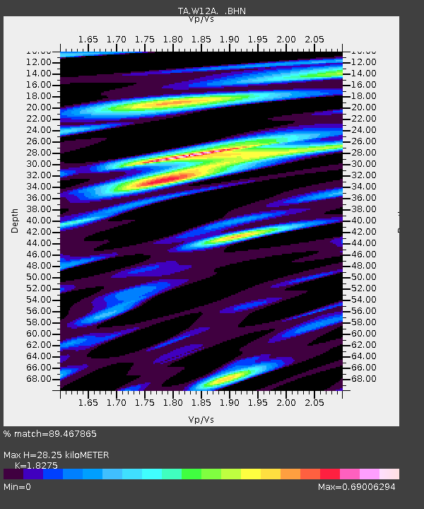
W12A Cal Nev Ari, NV, USA - Earthquake Result Viewer
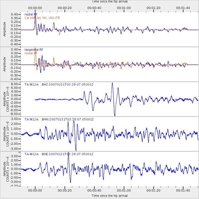
Earthquake location: Kermadec Islands, New Zealand
Earthquake latitude/longitude: -29.8/-178.0
Earthquake time(UTC): 2007/01/31 (031) 03:15:52 GMT
Earthquake Depth: 34 km
Earthquake Magnitude: 6.1 MB, 6.3 MS, 6.5 MW, 6.4 MW
Earthquake Catalog/Contributor: WHDF/NEIC
Network: TA USArray Transportable Network (new EarthScope stations)
Station: W12A Cal Nev Ari, NV, USA
Lat/Lon: 35.30 N/114.87 W
Elevation: 774 m
Distance: 87.9 deg
Az: 46.9 deg
Baz: 230.904 deg
Ray Param: 0.042962883
Estimated Moho Depth: 28.25 km
Estimated Crust Vp/Vs: 1.83
Assumed Crust Vp: 6.276 km/s
Estimated Crust Vs: 3.434 km/s
Estimated Crust Poisson's Ratio: 0.29
Radial Match: 89.467865 %
Radial Bump: 400
Transverse Match: 87.24035 %
Transverse Bump: 400
SOD ConfigId: 2564
Insert Time: 2010-03-06 22:13:45.373 +0000
GWidth: 2.5
Max Bumps: 400
Tol: 0.001

Signal To Noise

ChannelStoNSTALTA
TA:W12A: :BHN:20070131T03:28:07.05001Z3.07015093.6855144E-71.2004344E-7
TA:W12A: :BHE:20070131T03:28:07.05001Z6.0026185.8859183E-79.8055864E-8
TA:W12A: :BHZ:20070131T03:28:07.05001Z10.210211.4641711E-61.4340264E-7
Arrivals
Ps3.8 SECOND
PpPs12 SECOND
PsPs/PpSs16 SECOND