
W12A Cal Nev Ari, NV, USA - Earthquake Result Viewer
| ||||||||||||||||||
| ||||||||||||||||||
| ||||||||||||||||||
|
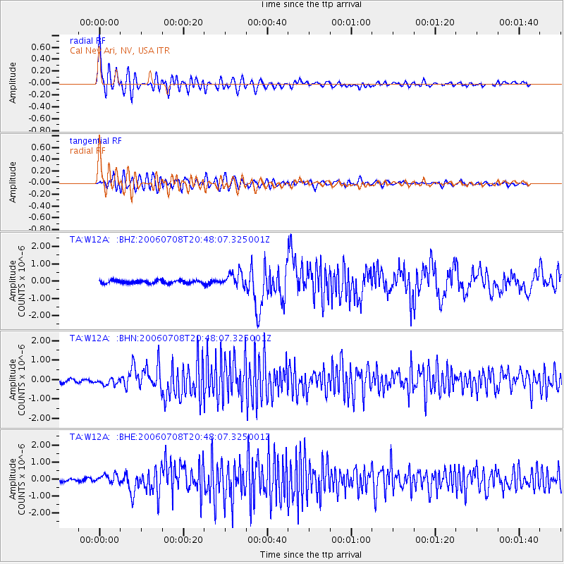
Signal To Noise
| Channel | StoN | STA | LTA |
| TA:W12A: :BHN:20060708T20:48:07.325001Z | 2.2133362 | 1.756822E-7 | 7.937439E-8 |
| TA:W12A: :BHE:20060708T20:48:07.325001Z | 3.8958032 | 2.4858457E-7 | 6.3808294E-8 |
| TA:W12A: :BHZ:20060708T20:48:07.325001Z | 4.6293764 | 4.181059E-7 | 9.0315815E-8 |
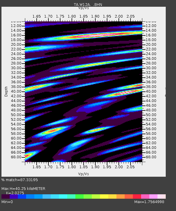
| Arrivals | |
| Ps | 6.9 SECOND |
| PpPs | 18 SECOND |
| PsPs/PpSs | 25 SECOND |

