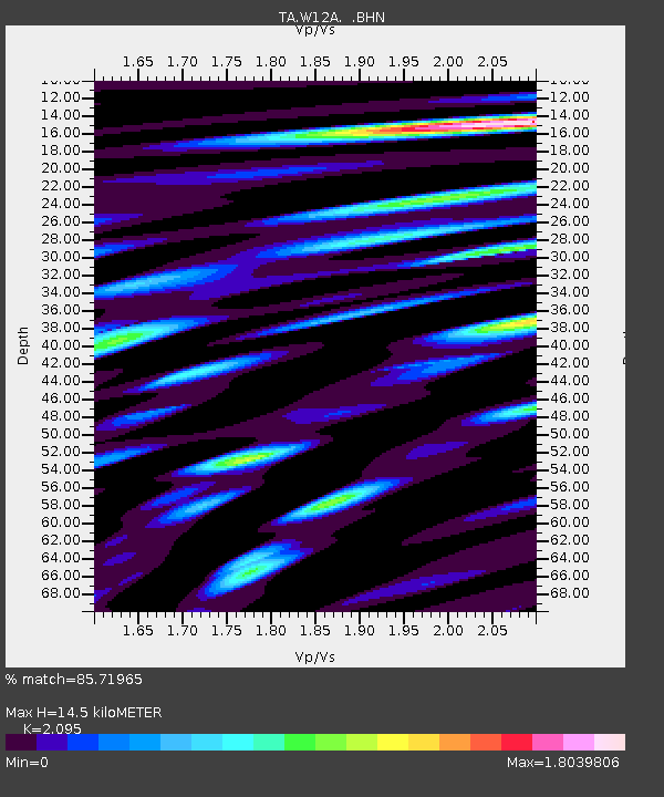
W12A Cal Nev Ari, NV, USA - Earthquake Result Viewer
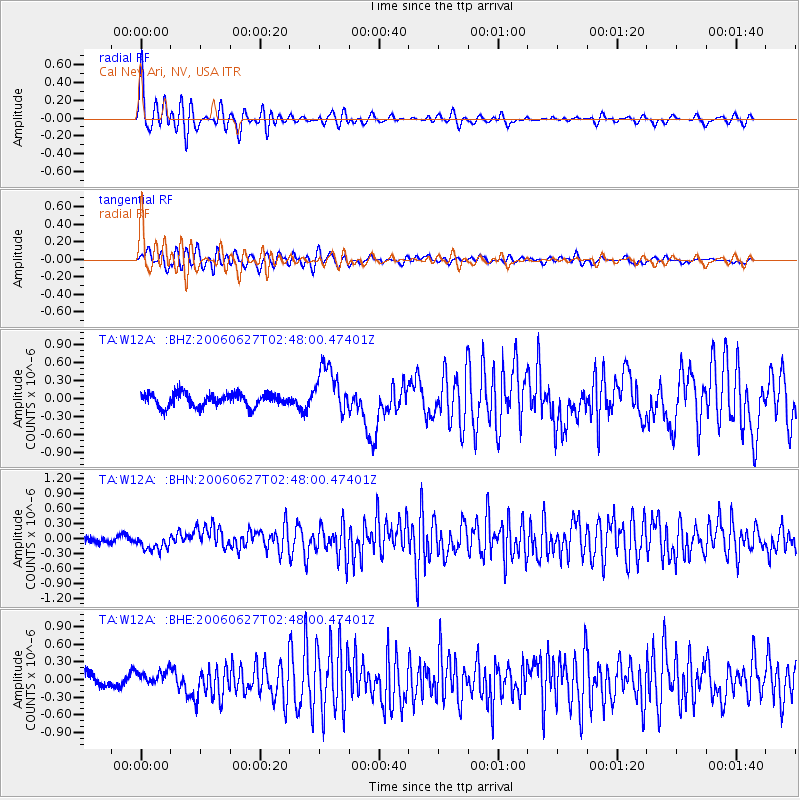
Earthquake location: Rat Islands, Aleutian Islands
Earthquake latitude/longitude: 52.2/176.2
Earthquake time(UTC): 2006/06/27 (178) 02:39:35 GMT
Earthquake Depth: 34 km
Earthquake Magnitude: 5.6 MB, 6.0 MS, 6.2 MW, 6.2 MW
Earthquake Catalog/Contributor: WHDF/NEIC
Network: TA USArray Transportable Network (new EarthScope stations)
Station: W12A Cal Nev Ari, NV, USA
Lat/Lon: 35.30 N/114.87 W
Elevation: 774 m
Distance: 50.6 deg
Az: 80.888 deg
Baz: 312.023 deg
Ray Param: 0.06785765
Estimated Moho Depth: 14.5 km
Estimated Crust Vp/Vs: 2.10
Assumed Crust Vp: 6.276 km/s
Estimated Crust Vs: 2.996 km/s
Estimated Crust Poisson's Ratio: 0.35
Radial Match: 85.71965 %
Radial Bump: 400
Transverse Match: 81.49558 %
Transverse Bump: 400
SOD ConfigId: 2665
Insert Time: 2010-03-06 22:14:30.558 +0000
GWidth: 2.5
Max Bumps: 400
Tol: 0.001

Signal To Noise

ChannelStoNSTALTA
TA:W12A: :BHN:20060627T02:48:00.47401Z2.5154511.630204E-76.480763E-8
TA:W12A: :BHE:20060627T02:48:00.47401Z1.38562921.3796888E-79.957129E-8
TA:W12A: :BHZ:20060627T02:48:00.47401Z3.7115444.0750456E-71.0979381E-7
Arrivals
Ps2.6 SECOND
PpPs6.8 SECOND
PsPs/PpSs9.5 SECOND