
W12A Cal Nev Ari, NV, USA - Earthquake Result Viewer
| ||||||||||||||||||
| ||||||||||||||||||
| ||||||||||||||||||
|
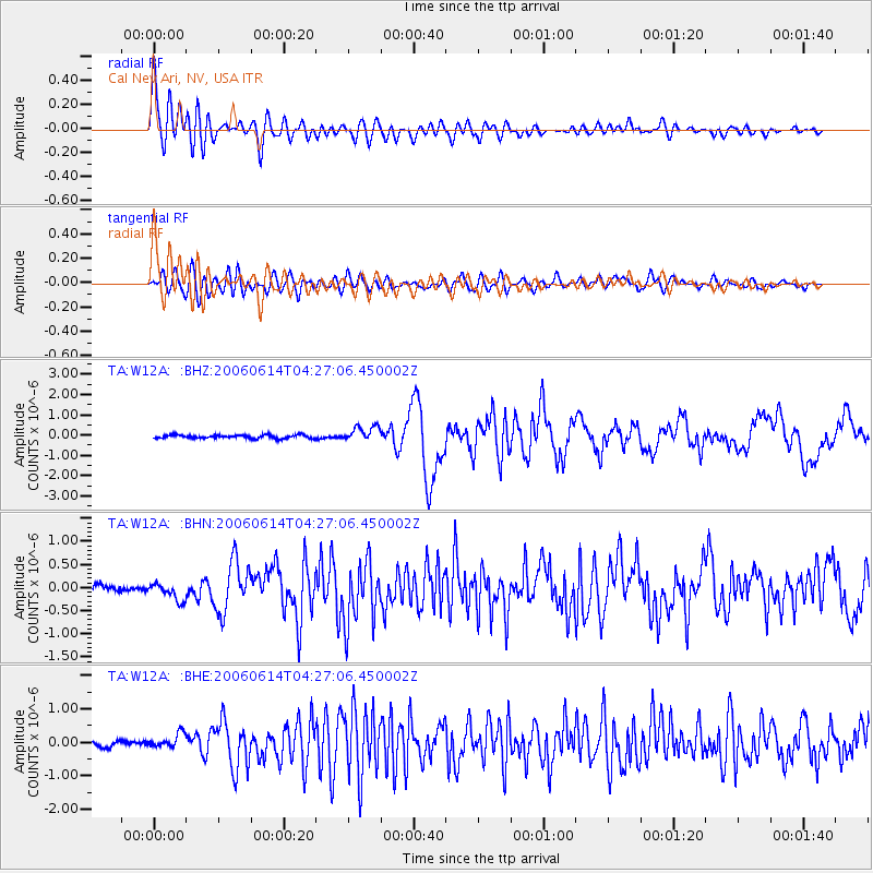
Signal To Noise
| Channel | StoN | STA | LTA |
| TA:W12A: :BHN:20060614T04:27:06.450002Z | 3.0314193 | 1.8385737E-7 | 6.065059E-8 |
| TA:W12A: :BHE:20060614T04:27:06.450002Z | 2.4317818 | 2.0756752E-7 | 8.535614E-8 |
| TA:W12A: :BHZ:20060614T04:27:06.450002Z | 4.4212227 | 3.747265E-7 | 8.475631E-8 |
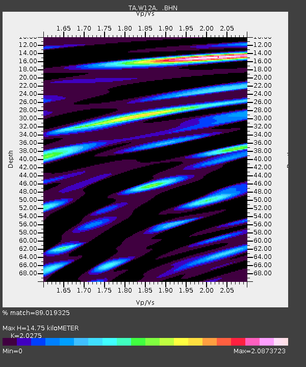
| Arrivals | |
| Ps | 2.5 SECOND |
| PpPs | 6.8 SECOND |
| PsPs/PpSs | 9.3 SECOND |

