You are here: Home > Network List > IC - New China Digital Seismograph Network Stations List
> Station HIA Hailar, Neimenggu Autonomous Region, China > Earthquake Result Viewer
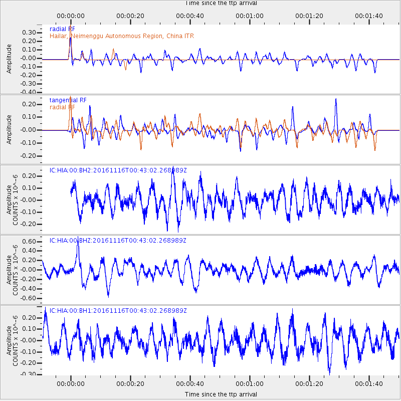
HIA Hailar, Neimenggu Autonomous Region, China - Earthquake Result Viewer
*The percent match for this event was below the threshold and hence no stack was calculated.
| Earthquake location: |
Tonga Islands Region |
| Earthquake latitude/longitude: |
-20.2/-173.0 |
| Earthquake time(UTC): |
2016/11/16 (321) 00:30:28 GMT |
| Earthquake Depth: |
10 km |
| Earthquake Magnitude: |
5.9 MB, 5.6 MWB |
| Earthquake Catalog/Contributor: |
NEIC PDE/NEIC COMCAT |
|
| Network: |
IC New China Digital Seismograph Network |
| Station: |
HIA Hailar, Neimenggu Autonomous Region, China |
| Lat/Lon: |
49.27 N/119.74 E |
| Elevation: |
620 m |
|
| Distance: |
91.3 deg |
| Az: |
322.815 deg |
| Baz: |
119.923 deg |
| Ray Param: |
$rayparam |
*The percent match for this event was below the threshold and hence was not used in the summary stack. |
|
| Radial Match: |
60.799194 % |
| Radial Bump: |
363 |
| Transverse Match: |
63.581005 % |
| Transverse Bump: |
293 |
| SOD ConfigId: |
1858631 |
| Insert Time: |
2016-11-30 00:32:20.903 +0000 |
| GWidth: |
2.5 |
| Max Bumps: |
400 |
| Tol: |
0.001 |
|
Signal To Noise
| Channel | StoN | STA | LTA |
| IC:HIA:00:BHZ:20161116T00:43:02.268989Z | 1.9557389 | 2.687288E-7 | 1.3740524E-7 |
| IC:HIA:00:BH1:20161116T00:43:02.268989Z | 0.762475 | 9.263154E-8 | 1.2148796E-7 |
| IC:HIA:00:BH2:20161116T00:43:02.268989Z | 1.743013 | 1.2964921E-7 | 7.4382235E-8 |
| Arrivals |
| Ps | |
| PpPs | |
| PsPs/PpSs | |


