You are here: Home > Network List > IC - New China Digital Seismograph Network Stations List
> Station HIA Hailar, Neimenggu Autonomous Region, China > Earthquake Result Viewer
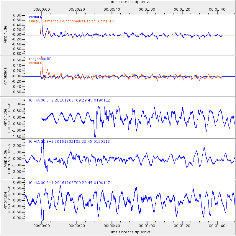
HIA Hailar, Neimenggu Autonomous Region, China - Earthquake Result Viewer
*The percent match for this event was below the threshold and hence no stack was calculated.
| Earthquake location: |
Near Islands, Aleutian Islands |
| Earthquake latitude/longitude: |
52.2/174.2 |
| Earthquake time(UTC): |
2016/12/03 (338) 09:23:34 GMT |
| Earthquake Depth: |
27 km |
| Earthquake Magnitude: |
6.0 mb |
| Earthquake Catalog/Contributor: |
NEIC PDE/us |
|
| Network: |
IC New China Digital Seismograph Network |
| Station: |
HIA Hailar, Neimenggu Autonomous Region, China |
| Lat/Lon: |
49.27 N/119.74 E |
| Elevation: |
620 m |
|
| Distance: |
33.9 deg |
| Az: |
287.138 deg |
| Baz: |
63.773 deg |
| Ray Param: |
$rayparam |
*The percent match for this event was below the threshold and hence was not used in the summary stack. |
|
| Radial Match: |
78.52364 % |
| Radial Bump: |
365 |
| Transverse Match: |
39.558914 % |
| Transverse Bump: |
350 |
| SOD ConfigId: |
1894071 |
| Insert Time: |
2016-12-17 09:26:20.284 +0000 |
| GWidth: |
2.5 |
| Max Bumps: |
400 |
| Tol: |
0.001 |
|
Signal To Noise
| Channel | StoN | STA | LTA |
| IC:HIA:00:BHZ:20161203T09:29:45.019011Z | 6.1999555 | 1.4287151E-6 | 2.3043957E-7 |
| IC:HIA:00:BH1:20161203T09:29:45.019011Z | 3.05049 | 5.1374246E-7 | 1.6841311E-7 |
| IC:HIA:00:BH2:20161203T09:29:45.019011Z | 3.2798696 | 7.5588696E-7 | 2.304625E-7 |
| Arrivals |
| Ps | |
| PpPs | |
| PsPs/PpSs | |


