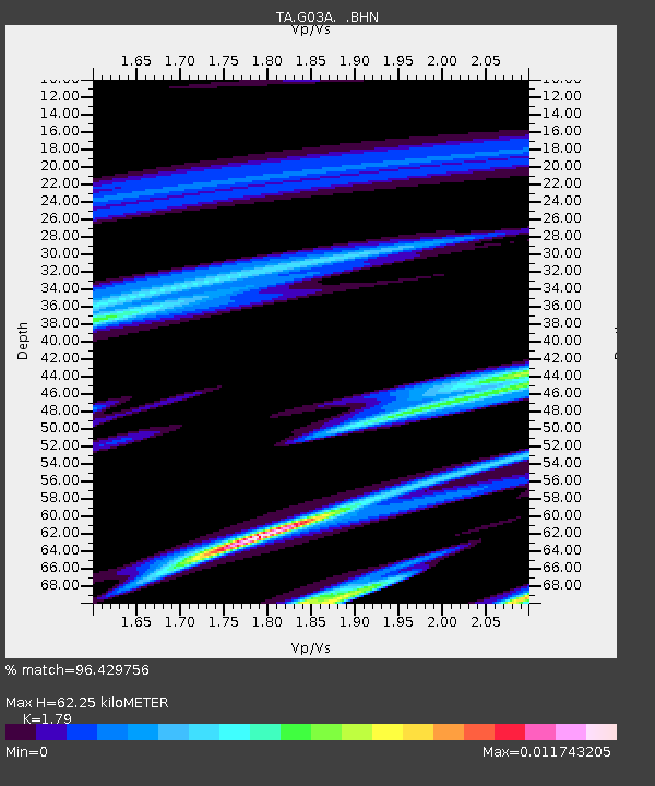
G03A Yamhill, OR, USA - Earthquake Result Viewer
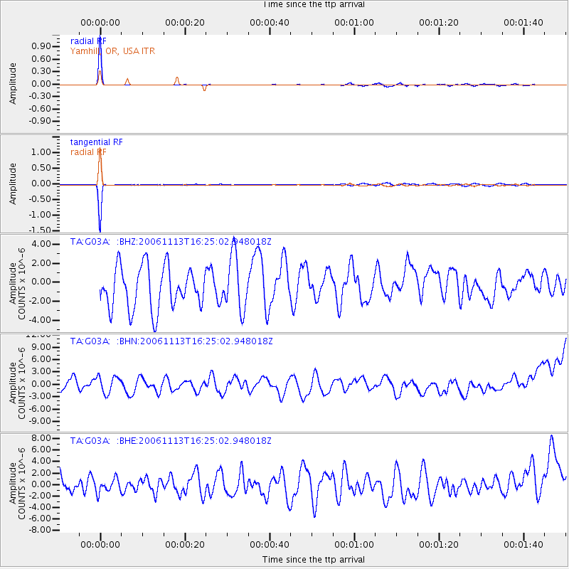
Earthquake location: New Britain Region, P.N.G.
Earthquake latitude/longitude: -6.4/151.2
Earthquake time(UTC): 2006/11/13 (317) 16:12:28 GMT
Earthquake Depth: 11 km
Earthquake Magnitude: 6.1 MB, 5.9 MS, 6.2 MW, 6.1 MW
Earthquake Catalog/Contributor: WHDF/NEIC
Network: TA USArray Transportable Network (new EarthScope stations)
Station: G03A Yamhill, OR, USA
Lat/Lon: 45.32 N/123.28 W
Elevation: 208 m
Distance: 91.3 deg
Az: 44.716 deg
Baz: 262.339 deg
Ray Param: 0.041610185
Estimated Moho Depth: 62.25 km
Estimated Crust Vp/Vs: 1.79
Assumed Crust Vp: 6.566 km/s
Estimated Crust Vs: 3.668 km/s
Estimated Crust Poisson's Ratio: 0.27
Radial Match: 96.429756 %
Radial Bump: 117
Transverse Match: 97.13093 %
Transverse Bump: 117
SOD ConfigId: 2564
Insert Time: 2010-03-07 01:00:28.041 +0000
GWidth: 2.5
Max Bumps: 400
Tol: 0.001

Signal To Noise

ChannelStoNSTALTA
TA:G03A: :BHN:20061113T16:25:02.948018Z1.18217522.1628298E-61.8295342E-6
TA:G03A: :BHE:20061113T16:25:02.948018Z0.528945451.1887188E-62.247337E-6
TA:G03A: :BHZ:20061113T16:25:02.948018Z1.32553612.9102646E-62.1955377E-6
Arrivals
Ps7.7 SECOND
PpPs26 SECOND
PsPs/PpSs34 SECOND