B09A Rice, WA, USA - Earthquake Result Viewer
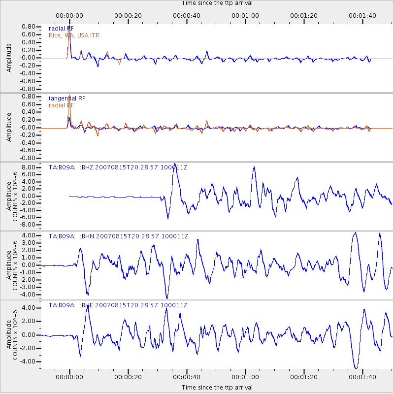
Earthquake location: Andreanof Islands, Aleutian Is.
Earthquake latitude/longitude: 50.3/-177.5
Earthquake time(UTC): 2007/08/15 (227) 20:22:11 GMT
Earthquake Depth: 9.0 km
Earthquake Magnitude: 6.3 MB, 6.2 MS, 6.4 MW, 5.9 ML
Earthquake Catalog/Contributor: WHDF/NEIC
Network: TA USArray Transportable Network (new EarthScope stations)
Station: B09A Rice, WA, USA
Lat/Lon: 48.42 N/118.15 W
Elevation: 630 m
Distance: 37.8 deg
Az: 69.197 deg
Baz: 295.899 deg
Ray Param: 0.07591564
Estimated Moho Depth: 32.25 km
Estimated Crust Vp/Vs: 1.76
Assumed Crust Vp: 6.419 km/s
Estimated Crust Vs: 3.642 km/s
Estimated Crust Poisson's Ratio: 0.26
Radial Match: 92.006165 %
Radial Bump: 349
Transverse Match: 83.92087 %
Transverse Bump: 400
SOD ConfigId: 2564
Insert Time: 2010-03-07 01:00:58.742 +0000
GWidth: 2.5
Max Bumps: 400
Tol: 0.001

Signal To Noise

ChannelStoNSTALTA
TA:B09A: :BHN:20070815T20:28:57.100011Z18.7733619.706715E-75.1704728E-8
TA:B09A: :BHE:20070815T20:28:57.100011Z29.5211491.0924643E-63.7006163E-8
TA:B09A: :BHZ:20070815T20:28:57.100011Z48.799562.3145415E-64.742956E-8
Arrivals
Ps4.1 SECOND
PpPs13 SECOND
PsPs/PpSs17 SECOND