B09A Rice, WA, USA - Earthquake Result Viewer
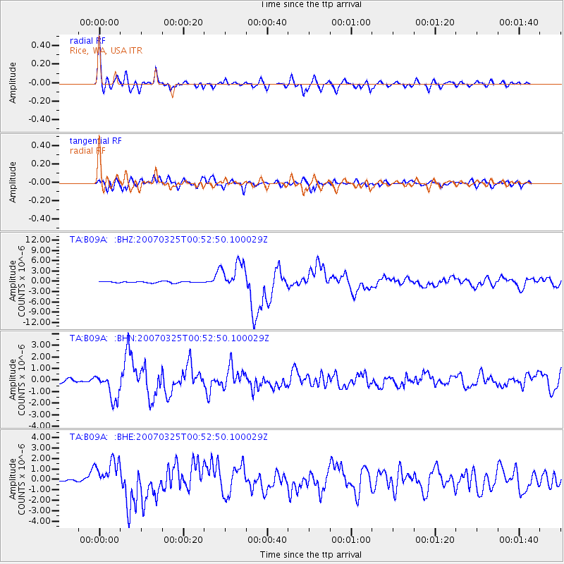
Earthquake location: Near West Coast Of Honshu, Japan
Earthquake latitude/longitude: 37.3/136.6
Earthquake time(UTC): 2007/03/25 (084) 00:41:57 GMT
Earthquake Depth: 8.0 km
Earthquake Magnitude: 6.1 MB, 6.8 MS, 6.7 MW, 6.6 MW
Earthquake Catalog/Contributor: WHDF/NEIC
Network: TA USArray Transportable Network (new EarthScope stations)
Station: B09A Rice, WA, USA
Lat/Lon: 48.42 N/118.15 W
Elevation: 630 m
Distance: 71.9 deg
Az: 42.538 deg
Baz: 306.005 deg
Ray Param: 0.054022506
Estimated Moho Depth: 31.75 km
Estimated Crust Vp/Vs: 1.83
Assumed Crust Vp: 6.419 km/s
Estimated Crust Vs: 3.517 km/s
Estimated Crust Poisson's Ratio: 0.29
Radial Match: 91.69175 %
Radial Bump: 400
Transverse Match: 82.08678 %
Transverse Bump: 400
SOD ConfigId: 2564
Insert Time: 2010-03-07 01:01:34.807 +0000
GWidth: 2.5
Max Bumps: 400
Tol: 0.001

Signal To Noise

ChannelStoNSTALTA
TA:B09A: :BHN:20070325T00:52:50.100029Z7.7544361.1829278E-61.5254852E-7
TA:B09A: :BHE:20070325T00:52:50.100029Z14.7797661.3632807E-69.223967E-8
TA:B09A: :BHZ:20070325T00:52:50.100029Z22.3815024.1160424E-61.8390377E-7
Arrivals
Ps4.2 SECOND
PpPs14 SECOND
PsPs/PpSs18 SECOND