I07A Izee, OR, USA - Earthquake Result Viewer
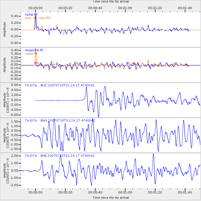
Earthquake location: Near West Coast Of Honshu, Japan
Earthquake latitude/longitude: 37.5/138.4
Earthquake time(UTC): 2007/07/16 (197) 01:13:22 GMT
Earthquake Depth: 12 km
Earthquake Magnitude: 6.5 MB, 6.4 MS, 6.6 MW, 6.5 MW
Earthquake Catalog/Contributor: WHDF/NEIC
Network: TA USArray Transportable Network (new EarthScope stations)
Station: I07A Izee, OR, USA
Lat/Lon: 44.08 N/119.50 W
Elevation: 1293 m
Distance: 72.5 deg
Az: 47.652 deg
Baz: 305.389 deg
Ray Param: 0.05362661
Estimated Moho Depth: 61.5 km
Estimated Crust Vp/Vs: 2.06
Assumed Crust Vp: 6.571 km/s
Estimated Crust Vs: 3.197 km/s
Estimated Crust Poisson's Ratio: 0.34
Radial Match: 91.66669 %
Radial Bump: 400
Transverse Match: 86.13556 %
Transverse Bump: 400
SOD ConfigId: 2564
Insert Time: 2010-03-07 01:28:33.236 +0000
GWidth: 2.5
Max Bumps: 400
Tol: 0.001

Signal To Noise

ChannelStoNSTALTA
TA:I07A: :BHN:20070716T01:24:17.474004Z11.1140244.7351037E-74.2604764E-8
TA:I07A: :BHE:20070716T01:24:17.474004Z9.64755255.389336E-75.5862206E-8
TA:I07A: :BHZ:20070716T01:24:17.474004Z37.331411.8799799E-65.03592E-8
Arrivals
Ps10 SECOND
PpPs28 SECOND
PsPs/PpSs38 SECOND