I07A Izee, OR, USA - Earthquake Result Viewer
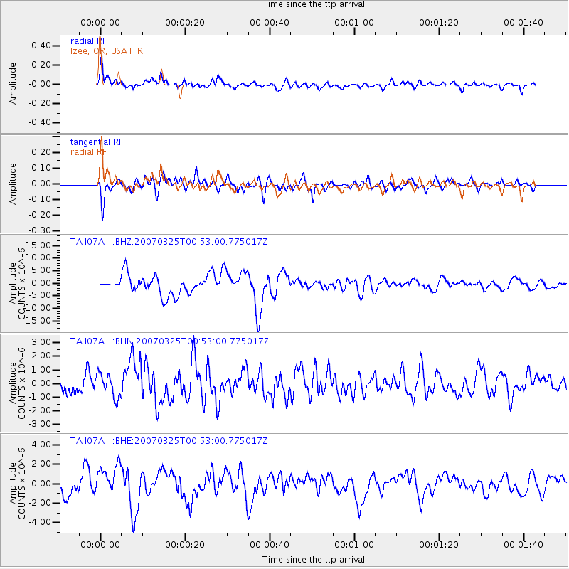
Earthquake location: Near West Coast Of Honshu, Japan
Earthquake latitude/longitude: 37.3/136.6
Earthquake time(UTC): 2007/03/25 (084) 00:41:57 GMT
Earthquake Depth: 8.0 km
Earthquake Magnitude: 6.1 MB, 6.8 MS, 6.7 MW, 6.6 MW
Earthquake Catalog/Contributor: WHDF/NEIC
Network: TA USArray Transportable Network (new EarthScope stations)
Station: I07A Izee, OR, USA
Lat/Lon: 44.08 N/119.50 W
Elevation: 1293 m
Distance: 73.7 deg
Az: 46.788 deg
Baz: 306.286 deg
Ray Param: 0.052831158
Estimated Moho Depth: 37.25 km
Estimated Crust Vp/Vs: 1.66
Assumed Crust Vp: 6.571 km/s
Estimated Crust Vs: 3.946 km/s
Estimated Crust Poisson's Ratio: 0.22
Radial Match: 85.646065 %
Radial Bump: 400
Transverse Match: 70.74214 %
Transverse Bump: 400
SOD ConfigId: 2564
Insert Time: 2010-03-07 01:28:47.766 +0000
GWidth: 2.5
Max Bumps: 400
Tol: 0.001

Signal To Noise

ChannelStoNSTALTA
TA:I07A: :BHN:20070325T00:53:00.775017Z1.4799878.6704995E-75.858497E-7
TA:I07A: :BHE:20070325T00:53:00.775017Z1.47621681.6617305E-61.1256683E-6
TA:I07A: :BHZ:20070325T00:53:00.775017Z1.46089635.142598E-63.5201663E-6
Arrivals
Ps3.9 SECOND
PpPs15 SECOND
PsPs/PpSs18 SECOND