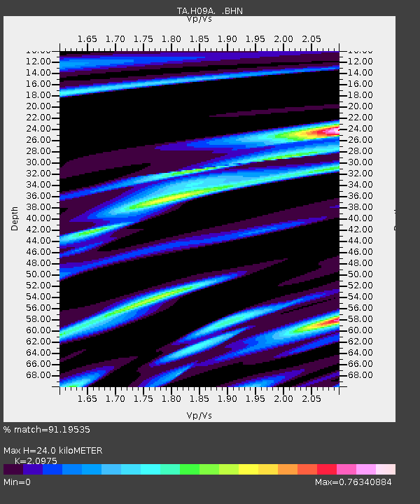
H09A Durkee, OR, USA - Earthquake Result Viewer
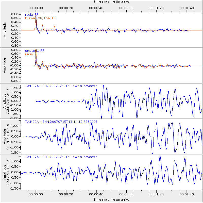
Earthquake location: Fox Islands, Aleutian Islands
Earthquake latitude/longitude: 52.5/-168.0
Earthquake time(UTC): 2007/07/15 (196) 13:08:00 GMT
Earthquake Depth: 10 km
Earthquake Magnitude: 5.8 MB, 5.9 MS, 6.1 MW, 6.0 MW
Earthquake Catalog/Contributor: WHDF/NEIC
Network: TA USArray Transportable Network (new EarthScope stations)
Station: H09A Durkee, OR, USA
Lat/Lon: 44.67 N/117.66 W
Elevation: 1263 m
Distance: 33.6 deg
Az: 82.897 deg
Baz: 301.729 deg
Ray Param: 0.07811563
Estimated Moho Depth: 24.0 km
Estimated Crust Vp/Vs: 2.10
Assumed Crust Vp: 6.571 km/s
Estimated Crust Vs: 3.133 km/s
Estimated Crust Poisson's Ratio: 0.35
Radial Match: 91.19535 %
Radial Bump: 318
Transverse Match: 83.26777 %
Transverse Bump: 400
SOD ConfigId: 2564
Insert Time: 2010-03-07 01:35:18.760 +0000
GWidth: 2.5
Max Bumps: 400
Tol: 0.001

Signal To Noise

ChannelStoNSTALTA
TA:H09A: :BHN:20070715T13:14:10.725009Z4.00657371.3104746E-73.2708108E-8
TA:H09A: :BHE:20070715T13:14:10.725009Z2.25511889.2936496E-84.121135E-8
TA:H09A: :BHZ:20070715T13:14:10.725009Z4.91138122.6590033E-75.4139626E-8
Arrivals
Ps4.3 SECOND
PpPs11 SECOND
PsPs/PpSs15 SECOND