You are here: Home > Network List > TA - USArray Transportable Network (new EarthScope stations) Stations List
> Station H09A Durkee, OR, USA > Earthquake Result Viewer
H09A Durkee, OR, USA - Earthquake Result Viewer

| Earthquake location: |
Northern Mid-Atlantic Ridge |
| Earthquake latitude/longitude: |
52.4/-31.8 |
| Earthquake time(UTC): |
2007/05/23 (143) 04:41:46 GMT |
| Earthquake Depth: |
10 km |
| Earthquake Magnitude: |
5.6 MS, 5.4 MB, 5.7 MW, 5.6 MW |
| Earthquake Catalog/Contributor: |
WHDF/NEIC |
|
| Network: |
TA USArray Transportable Network (new EarthScope stations) |
| Station: |
H09A Durkee, OR, USA |
| Lat/Lon: |
44.67 N/117.66 W |
| Elevation: |
1263 m |
|
| Distance: |
54.2 deg |
| Az: |
298.656 deg |
| Baz: |
48.964 deg |
| Ray Param: |
0.065597355 |
| Estimated Moho Depth: |
53.0 km |
| Estimated Crust Vp/Vs: |
1.98 |
| Assumed Crust Vp: |
6.571 km/s |
| Estimated Crust Vs: |
3.314 km/s |
| Estimated Crust Poisson's Ratio: |
0.33 |
|
| Radial Match: |
83.50076 % |
| Radial Bump: |
400 |
| Transverse Match: |
70.52816 % |
| Transverse Bump: |
400 |
| SOD ConfigId: |
2564 |
| Insert Time: |
2010-03-07 01:35:26.566 +0000 |
| GWidth: |
2.5 |
| Max Bumps: |
400 |
| Tol: |
0.001 |
|
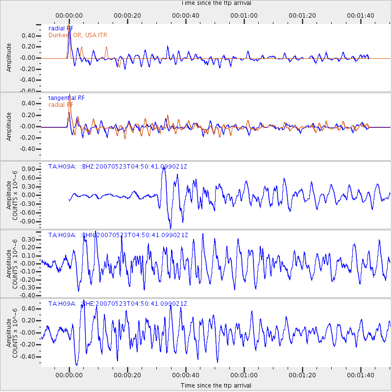
Signal To Noise
| Channel | StoN | STA | LTA |
| TA:H09A: :BHN:20070523T04:50:41.099021Z | 2.3392377 | 1.5186528E-7 | 6.492084E-8 |
| TA:H09A: :BHE:20070523T04:50:41.099021Z | 4.711217 | 3.0424107E-7 | 6.4578025E-8 |
| TA:H09A: :BHZ:20070523T04:50:41.099021Z | 9.8110895 | 5.9365726E-7 | 6.0508796E-8 |
| Arrivals |
| Ps | 8.3 SECOND |
| PpPs | 23 SECOND |
| PsPs/PpSs | 31 SECOND |


