H09A Durkee, OR, USA - Earthquake Result Viewer
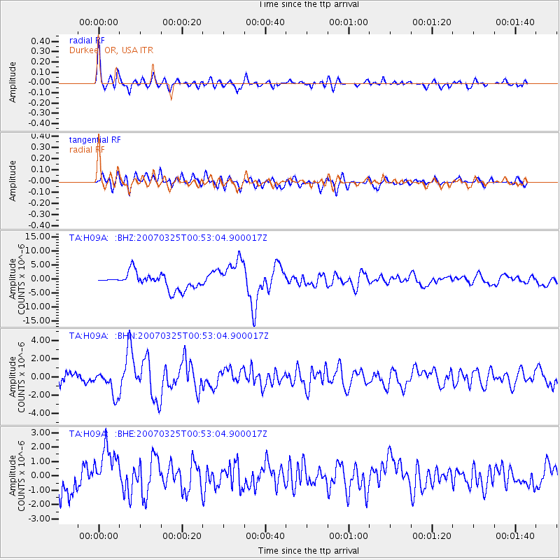
Earthquake location: Near West Coast Of Honshu, Japan
Earthquake latitude/longitude: 37.3/136.6
Earthquake time(UTC): 2007/03/25 (084) 00:41:57 GMT
Earthquake Depth: 8.0 km
Earthquake Magnitude: 6.1 MB, 6.8 MS, 6.7 MW, 6.6 MW
Earthquake Catalog/Contributor: WHDF/NEIC
Network: TA USArray Transportable Network (new EarthScope stations)
Station: H09A Durkee, OR, USA
Lat/Lon: 44.67 N/117.66 W
Elevation: 1263 m
Distance: 74.4 deg
Az: 45.482 deg
Baz: 307.21 deg
Ray Param: 0.052354954
Estimated Moho Depth: 50.25 km
Estimated Crust Vp/Vs: 1.61
Assumed Crust Vp: 6.571 km/s
Estimated Crust Vs: 4.094 km/s
Estimated Crust Poisson's Ratio: 0.18
Radial Match: 87.72344 %
Radial Bump: 400
Transverse Match: 69.04408 %
Transverse Bump: 400
SOD ConfigId: 2564
Insert Time: 2010-03-07 01:35:29.912 +0000
GWidth: 2.5
Max Bumps: 400
Tol: 0.001

Signal To Noise

ChannelStoNSTALTA
TA:H09A: :BHN:20070325T00:53:04.900017Z4.15732151.4074769E-63.385538E-7
TA:H09A: :BHE:20070325T00:53:04.900017Z1.54555271.6551795E-61.0709305E-6
TA:H09A: :BHZ:20070325T00:53:04.900017Z2.26809126.039326E-62.6627351E-6
Arrivals
Ps4.8 SECOND
PpPs19 SECOND
PsPs/PpSs24 SECOND