You are here: Home > Network List > IC - New China Digital Seismograph Network Stations List
> Station HIA Hailar, Neimenggu Autonomous Region, China > Earthquake Result Viewer
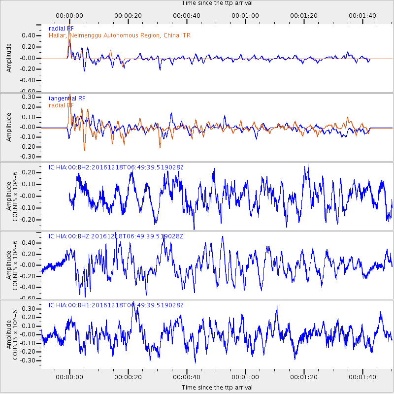
HIA Hailar, Neimenggu Autonomous Region, China - Earthquake Result Viewer
*The percent match for this event was below the threshold and hence no stack was calculated.
| Earthquake location: |
Solomon Islands |
| Earthquake latitude/longitude: |
-6.3/154.3 |
| Earthquake time(UTC): |
2016/12/18 (353) 06:39:43 GMT |
| Earthquake Depth: |
10 km |
| Earthquake Magnitude: |
5.8 Mww |
| Earthquake Catalog/Contributor: |
NEIC PDE/us |
|
| Network: |
IC New China Digital Seismograph Network |
| Station: |
HIA Hailar, Neimenggu Autonomous Region, China |
| Lat/Lon: |
49.27 N/119.74 E |
| Elevation: |
620 m |
|
| Distance: |
63.1 deg |
| Az: |
335.343 deg |
| Baz: |
140.721 deg |
| Ray Param: |
$rayparam |
*The percent match for this event was below the threshold and hence was not used in the summary stack. |
|
| Radial Match: |
71.751335 % |
| Radial Bump: |
400 |
| Transverse Match: |
66.71862 % |
| Transverse Bump: |
400 |
| SOD ConfigId: |
1894071 |
| Insert Time: |
2017-01-01 06:40:38.325 +0000 |
| GWidth: |
2.5 |
| Max Bumps: |
400 |
| Tol: |
0.001 |
|
Signal To Noise
| Channel | StoN | STA | LTA |
| IC:HIA:00:BHZ:20161218T06:49:39.519028Z | 3.675939 | 2.485389E-7 | 6.7612355E-8 |
| IC:HIA:00:BH1:20161218T06:49:39.519028Z | 2.044571 | 1.3300368E-7 | 6.505213E-8 |
| IC:HIA:00:BH2:20161218T06:49:39.519028Z | 1.4871888 | 1.3163951E-7 | 8.851567E-8 |
| Arrivals |
| Ps | |
| PpPs | |
| PsPs/PpSs | |


