X13A Yucca, AZ, USA - Earthquake Result Viewer
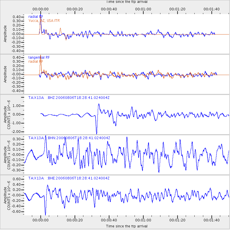
Earthquake location: Bonin Islands, Japan Region
Earthquake latitude/longitude: 26.1/144.0
Earthquake time(UTC): 2006/08/06 (218) 18:16:40 GMT
Earthquake Depth: 23 km
Earthquake Magnitude: 6.0 MB, 5.6 MS, 5.8 MW, 5.8 MW
Earthquake Catalog/Contributor: WHDF/NEIC
Network: TA USArray Transportable Network (new EarthScope stations)
Station: X13A Yucca, AZ, USA
Lat/Lon: 34.59 N/113.83 W
Elevation: 889 m
Distance: 84.8 deg
Az: 54.08 deg
Baz: 298.05 deg
Ray Param: 0.045223236
Estimated Moho Depth: 32.5 km
Estimated Crust Vp/Vs: 1.63
Assumed Crust Vp: 6.276 km/s
Estimated Crust Vs: 3.838 km/s
Estimated Crust Poisson's Ratio: 0.20
Radial Match: 80.98868 %
Radial Bump: 400
Transverse Match: 77.89078 %
Transverse Bump: 400
SOD ConfigId: 2665
Insert Time: 2010-03-07 02:20:13.329 +0000
GWidth: 2.5
Max Bumps: 400
Tol: 0.001

Signal To Noise

ChannelStoNSTALTA
TA:X13A: :BHN:20060806T18:28:41.024004Z2.30337261.4310525E-76.212857E-8
TA:X13A: :BHE:20060806T18:28:41.024004Z3.78096492.636109E-76.9720535E-8
TA:X13A: :BHZ:20060806T18:28:41.024004Z9.1754218.507989E-79.272588E-8
Arrivals
Ps3.4 SECOND
PpPs13 SECOND
PsPs/PpSs17 SECOND