
E03A Lebam, WA, USA - Earthquake Result Viewer
| ||||||||||||||||||
| ||||||||||||||||||
| ||||||||||||||||||
|
Signal To Noise
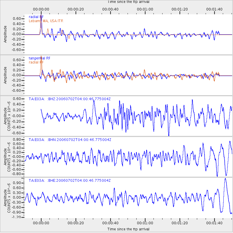
| Channel | StoN | STA | LTA |
| TA:E03A: :BHN:20060702T04:00:46.775004Z | 1.2097555 | 1.342045E-7 | 1.10935225E-7 |
| TA:E03A: :BHE:20060702T04:00:46.775004Z | 1.015959 | 1.6732577E-7 | 1.6469737E-7 |
| TA:E03A: :BHZ:20060702T04:00:46.775004Z | 2.9643593 | 2.4580268E-7 | 8.2919335E-8 |
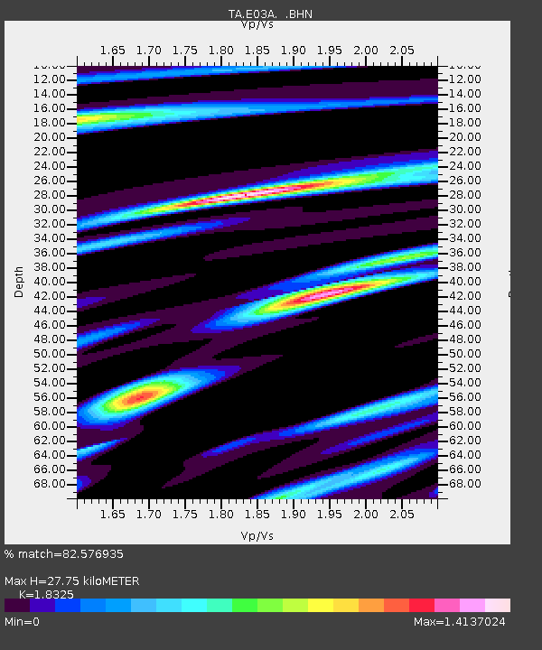
| Arrivals | |
| Ps | 3.8 SECOND |
| PpPs | 11 SECOND |
| PsPs/PpSs | 15 SECOND |

