You are here: Home > Network List > TA - USArray Transportable Network (new EarthScope stations) Stations List
> Station D06A Cle Elum, WA, USA > Earthquake Result Viewer
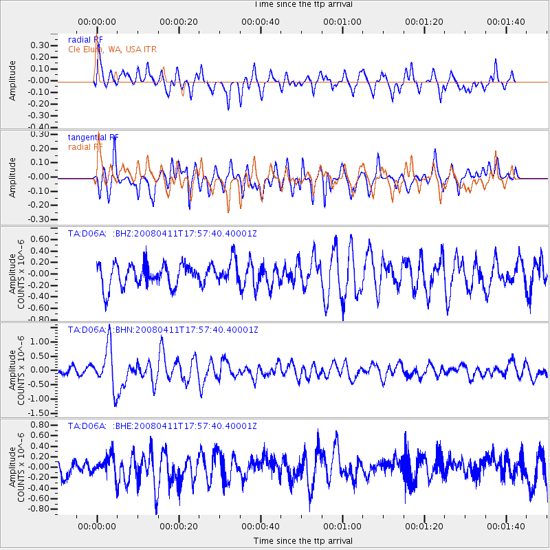
D06A Cle Elum, WA, USA - Earthquake Result Viewer
*The percent match for this event was below the threshold and hence no stack was calculated.
| Earthquake location: |
Loyalty Islands |
| Earthquake latitude/longitude: |
-20.4/168.8 |
| Earthquake time(UTC): |
2008/04/11 (102) 17:45:05 GMT |
| Earthquake Depth: |
35 km |
| Earthquake Magnitude: |
5.7 MB, 5.9 MS, 6.0 MW, 6.0 MW |
| Earthquake Catalog/Contributor: |
WHDF/NEIC |
|
| Network: |
TA USArray Transportable Network (new EarthScope stations) |
| Station: |
D06A Cle Elum, WA, USA |
| Lat/Lon: |
47.19 N/120.84 W |
| Elevation: |
575 m |
|
| Distance: |
92.2 deg |
| Az: |
39.992 deg |
| Baz: |
242.125 deg |
| Ray Param: |
$rayparam |
*The percent match for this event was below the threshold and hence was not used in the summary stack. |
|
| Radial Match: |
67.78901 % |
| Radial Bump: |
400 |
| Transverse Match: |
65.8741 % |
| Transverse Bump: |
400 |
| SOD ConfigId: |
2504 |
| Insert Time: |
2010-03-07 02:53:37.878 +0000 |
| GWidth: |
2.5 |
| Max Bumps: |
400 |
| Tol: |
0.001 |
|
Signal To Noise
| Channel | StoN | STA | LTA |
| TA:D06A: :BHN:20080411T17:57:40.40001Z | 4.00593 | 7.479853E-7 | 1.8671952E-7 |
| TA:D06A: :BHE:20080411T17:57:40.40001Z | 0.8125513 | 1.759289E-7 | 2.165142E-7 |
| TA:D06A: :BHZ:20080411T17:57:40.40001Z | 1.1043732 | 2.164243E-7 | 1.9597026E-7 |
| Arrivals |
| Ps | |
| PpPs | |
| PsPs/PpSs | |


