You are here: Home > Network List > TA - USArray Transportable Network (new EarthScope stations) Stations List
> Station D06A Cle Elum, WA, USA > Earthquake Result Viewer
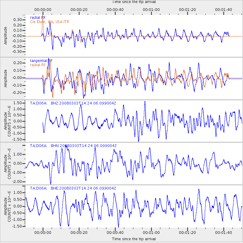
D06A Cle Elum, WA, USA - Earthquake Result Viewer
*The percent match for this event was below the threshold and hence no stack was calculated.
| Earthquake location: |
Philippine Islands Region |
| Earthquake latitude/longitude: |
13.4/125.6 |
| Earthquake time(UTC): |
2008/03/03 (063) 14:11:14 GMT |
| Earthquake Depth: |
24 km |
| Earthquake Magnitude: |
6.4 MB, 6.9 MW, 6.8 MW |
| Earthquake Catalog/Contributor: |
WHDF/NEIC |
|
| Network: |
TA USArray Transportable Network (new EarthScope stations) |
| Station: |
D06A Cle Elum, WA, USA |
| Lat/Lon: |
47.19 N/120.84 W |
| Elevation: |
575 m |
|
| Distance: |
95.6 deg |
| Az: |
38.922 deg |
| Baz: |
296.277 deg |
| Ray Param: |
$rayparam |
*The percent match for this event was below the threshold and hence was not used in the summary stack. |
|
| Radial Match: |
57.825226 % |
| Radial Bump: |
400 |
| Transverse Match: |
63.018875 % |
| Transverse Bump: |
400 |
| SOD ConfigId: |
2504 |
| Insert Time: |
2010-03-07 02:53:45.699 +0000 |
| GWidth: |
2.5 |
| Max Bumps: |
400 |
| Tol: |
0.001 |
|
Signal To Noise
| Channel | StoN | STA | LTA |
| TA:D06A: :BHN:20080303T14:24:06.099004Z | 4.1033473 | 8.1506954E-7 | 1.9863528E-7 |
| TA:D06A: :BHE:20080303T14:24:06.099004Z | 0.55163145 | 2.1434008E-7 | 3.8855666E-7 |
| TA:D06A: :BHZ:20080303T14:24:06.099004Z | 0.6247705 | 3.203816E-7 | 5.1279886E-7 |
| Arrivals |
| Ps | |
| PpPs | |
| PsPs/PpSs | |


