
B07A Winthrop, WA, USA - Earthquake Result Viewer
| ||||||||||||||||||
| ||||||||||||||||||
| ||||||||||||||||||
|
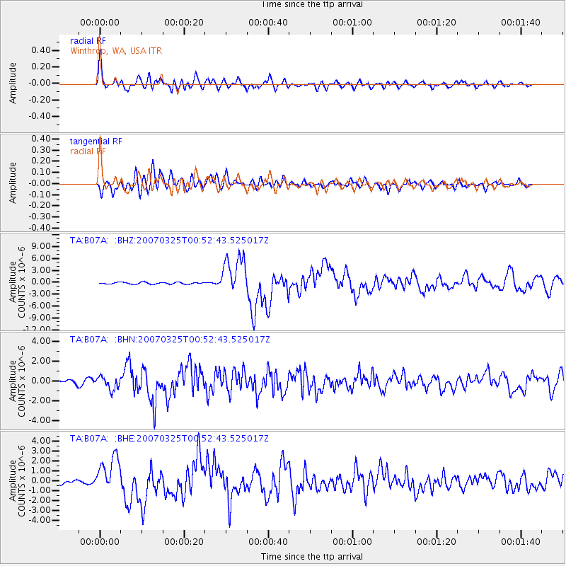
Signal To Noise
| Channel | StoN | STA | LTA |
| TA:B07A: :BHN:20070325T00:52:43.525017Z | 4.2020693 | 6.537297E-7 | 1.555733E-7 |
| TA:B07A: :BHE:20070325T00:52:43.525017Z | 9.192395 | 1.8500966E-6 | 2.0126383E-7 |
| TA:B07A: :BHZ:20070325T00:52:43.525017Z | 22.228992 | 5.01429E-6 | 2.2557433E-7 |
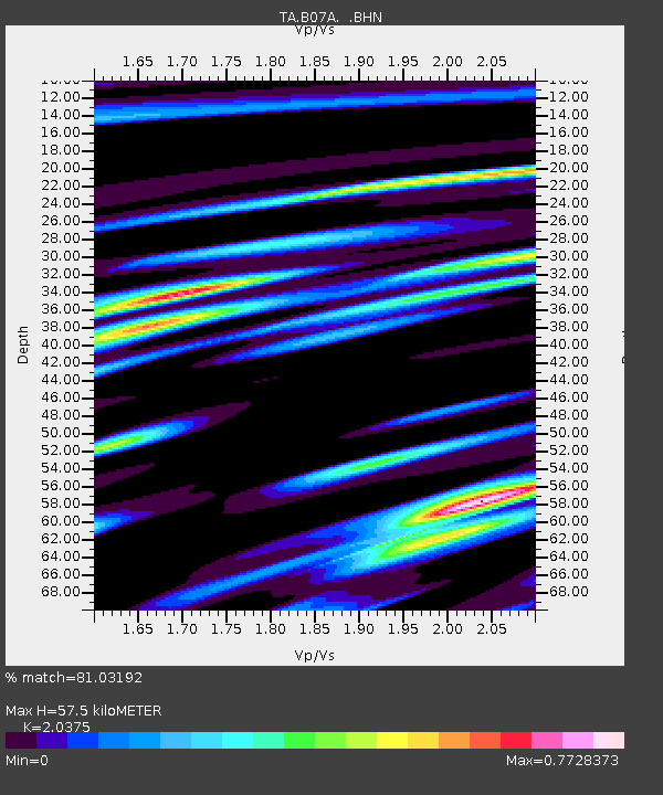
| Arrivals | |
| Ps | 9.4 SECOND |
| PpPs | 26 SECOND |
| PsPs/PpSs | 35 SECOND |

