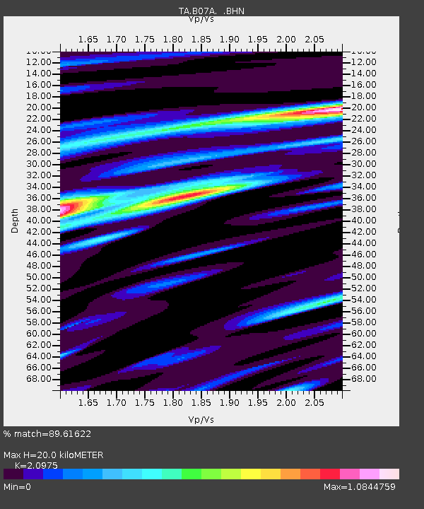
B07A Winthrop, WA, USA - Earthquake Result Viewer
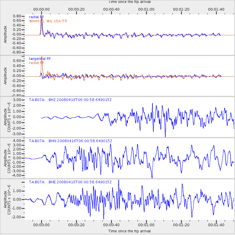
Earthquake location: Andreanof Islands, Aleutian Is.
Earthquake latitude/longitude: 51.9/-179.2
Earthquake time(UTC): 2008/04/16 (107) 05:54:19 GMT
Earthquake Depth: 13 km
Earthquake Magnitude: 6.1 MB, 6.5 MS, 6.6 MW, 6.6 MW
Earthquake Catalog/Contributor: WHDF/NEIC
Network: TA USArray Transportable Network (new EarthScope stations)
Station: B07A Winthrop, WA, USA
Lat/Lon: 48.46 N/120.12 W
Elevation: 781 m
Distance: 37.1 deg
Az: 71.232 deg
Baz: 298.141 deg
Ray Param: 0.07632551
Estimated Moho Depth: 20.0 km
Estimated Crust Vp/Vs: 2.10
Assumed Crust Vp: 6.566 km/s
Estimated Crust Vs: 3.13 km/s
Estimated Crust Poisson's Ratio: 0.35
Radial Match: 89.61622 %
Radial Bump: 400
Transverse Match: 70.59822 %
Transverse Bump: 400
SOD ConfigId: 2504
Insert Time: 2010-03-07 02:56:22.387 +0000
GWidth: 2.5
Max Bumps: 400
Tol: 0.001

Signal To Noise

ChannelStoNSTALTA
TA:B07A: :BHN:20080416T06:00:58.649015Z4.0210595.077007E-71.2626045E-7
TA:B07A: :BHE:20080416T06:00:58.649015Z2.58583193.4765225E-71.3444503E-7
TA:B07A: :BHZ:20080416T06:00:58.649015Z3.15623573.778774E-71.1972408E-7
Arrivals
Ps3.6 SECOND
PpPs8.8 SECOND
PsPs/PpSs12 SECOND