You are here: Home > Network List > TA - USArray Transportable Network (new EarthScope stations) Stations List
> Station B07A Winthrop, WA, USA > Earthquake Result Viewer
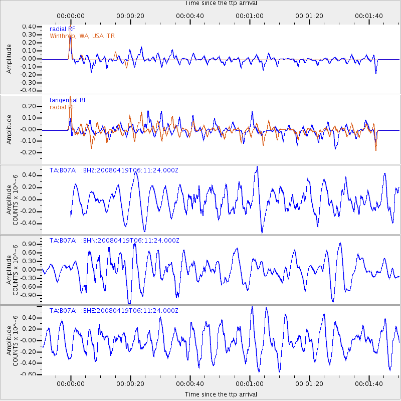
B07A Winthrop, WA, USA - Earthquake Result Viewer
*The percent match for this event was below the threshold and hence no stack was calculated.
| Earthquake location: |
Loyalty Islands |
| Earthquake latitude/longitude: |
-20.3/168.8 |
| Earthquake time(UTC): |
2008/04/19 (110) 05:58:42 GMT |
| Earthquake Depth: |
14 km |
| Earthquake Magnitude: |
5.7 MB, 6.2 MS, 6.3 MW, 6.2 MW |
| Earthquake Catalog/Contributor: |
WHDF/NEIC |
|
| Network: |
TA USArray Transportable Network (new EarthScope stations) |
| Station: |
B07A Winthrop, WA, USA |
| Lat/Lon: |
48.46 N/120.12 W |
| Elevation: |
781 m |
|
| Distance: |
93.1 deg |
| Az: |
39.096 deg |
| Baz: |
242.801 deg |
| Ray Param: |
$rayparam |
*The percent match for this event was below the threshold and hence was not used in the summary stack. |
|
| Radial Match: |
58.81172 % |
| Radial Bump: |
400 |
| Transverse Match: |
70.83495 % |
| Transverse Bump: |
400 |
| SOD ConfigId: |
2504 |
| Insert Time: |
2010-03-07 02:56:35.993 +0000 |
| GWidth: |
2.5 |
| Max Bumps: |
400 |
| Tol: |
0.001 |
|
Signal To Noise
| Channel | StoN | STA | LTA |
| TA:B07A: :BHN:20080419T06:11:24.000Z | 3.282249 | 3.8252213E-7 | 1.16542694E-7 |
| TA:B07A: :BHE:20080419T06:11:24.000Z | 1.1610265 | 1.9050728E-7 | 1.6408522E-7 |
| TA:B07A: :BHZ:20080419T06:11:24.000Z | 0.7729476 | 1.669827E-7 | 2.1603367E-7 |
| Arrivals |
| Ps | |
| PpPs | |
| PsPs/PpSs | |


