You are here: Home > Network List > TA - USArray Transportable Network (new EarthScope stations) Stations List
> Station B07A Winthrop, WA, USA > Earthquake Result Viewer
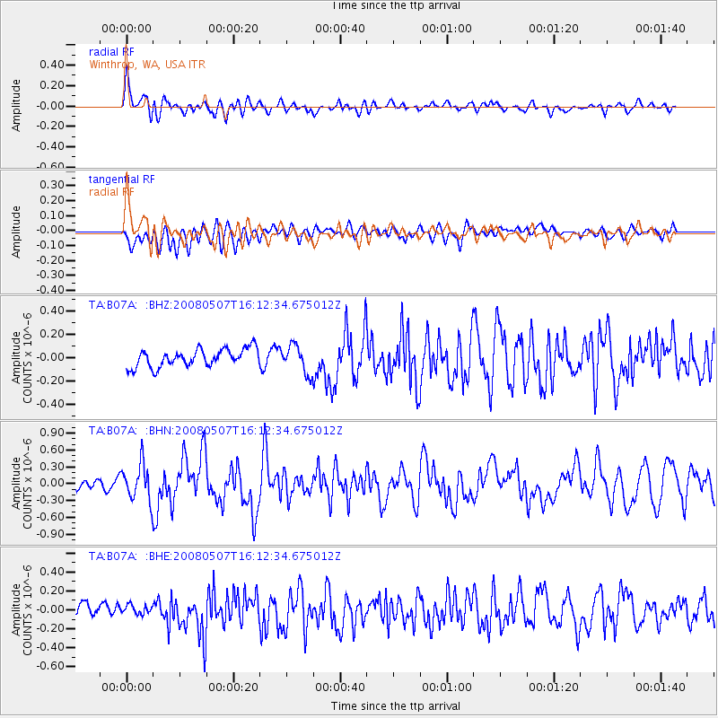
B07A Winthrop, WA, USA - Earthquake Result Viewer
*The percent match for this event was below the threshold and hence no stack was calculated.
| Earthquake location: |
Near East Coast Of Honshu, Japan |
| Earthquake latitude/longitude: |
36.2/141.5 |
| Earthquake time(UTC): |
2008/05/07 (128) 16:02:02 GMT |
| Earthquake Depth: |
19 km |
| Earthquake Magnitude: |
5.7 MB, 6.2 MW, 6.2 MW |
| Earthquake Catalog/Contributor: |
WHDF/NEIC |
|
| Network: |
TA USArray Transportable Network (new EarthScope stations) |
| Station: |
B07A Winthrop, WA, USA |
| Lat/Lon: |
48.46 N/120.12 W |
| Elevation: |
781 m |
|
| Distance: |
68.9 deg |
| Az: |
44.917 deg |
| Baz: |
300.88 deg |
| Ray Param: |
$rayparam |
*The percent match for this event was below the threshold and hence was not used in the summary stack. |
|
| Radial Match: |
69.02619 % |
| Radial Bump: |
400 |
| Transverse Match: |
55.82061 % |
| Transverse Bump: |
400 |
| SOD ConfigId: |
2504 |
| Insert Time: |
2010-03-07 02:56:40.357 +0000 |
| GWidth: |
2.5 |
| Max Bumps: |
400 |
| Tol: |
0.001 |
|
Signal To Noise
| Channel | StoN | STA | LTA |
| TA:B07A: :BHN:20080507T16:12:34.675012Z | 3.3803098 | 3.2664008E-7 | 9.663022E-8 |
| TA:B07A: :BHE:20080507T16:12:34.675012Z | 0.7217945 | 4.9730037E-8 | 6.889778E-8 |
| TA:B07A: :BHZ:20080507T16:12:34.675012Z | 1.5740415 | 1.1838835E-7 | 7.521298E-8 |
| Arrivals |
| Ps | |
| PpPs | |
| PsPs/PpSs | |


