You are here: Home > Network List > TA - USArray Transportable Network (new EarthScope stations) Stations List
> Station B07A Winthrop, WA, USA > Earthquake Result Viewer
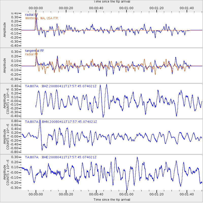
B07A Winthrop, WA, USA - Earthquake Result Viewer
*The percent match for this event was below the threshold and hence no stack was calculated.
| Earthquake location: |
Loyalty Islands |
| Earthquake latitude/longitude: |
-20.4/168.8 |
| Earthquake time(UTC): |
2008/04/11 (102) 17:45:05 GMT |
| Earthquake Depth: |
35 km |
| Earthquake Magnitude: |
5.7 MB, 5.9 MS, 6.0 MW, 6.0 MW |
| Earthquake Catalog/Contributor: |
WHDF/NEIC |
|
| Network: |
TA USArray Transportable Network (new EarthScope stations) |
| Station: |
B07A Winthrop, WA, USA |
| Lat/Lon: |
48.46 N/120.12 W |
| Elevation: |
781 m |
|
| Distance: |
93.2 deg |
| Az: |
39.093 deg |
| Baz: |
242.703 deg |
| Ray Param: |
$rayparam |
*The percent match for this event was below the threshold and hence was not used in the summary stack. |
|
| Radial Match: |
56.80908 % |
| Radial Bump: |
400 |
| Transverse Match: |
63.30969 % |
| Transverse Bump: |
312 |
| SOD ConfigId: |
2504 |
| Insert Time: |
2010-03-07 02:56:44.891 +0000 |
| GWidth: |
2.5 |
| Max Bumps: |
400 |
| Tol: |
0.001 |
|
Signal To Noise
| Channel | StoN | STA | LTA |
| TA:B07A: :BHN:20080411T17:57:45.074021Z | 3.9809716 | 4.0604917E-7 | 1.019975E-7 |
| TA:B07A: :BHE:20080411T17:57:45.074021Z | 1.0006417 | 7.5477175E-8 | 7.542877E-8 |
| TA:B07A: :BHZ:20080411T17:57:45.074021Z | 0.91511196 | 1.4511882E-7 | 1.585804E-7 |
| Arrivals |
| Ps | |
| PpPs | |
| PsPs/PpSs | |


