You are here: Home > Network List > TA - USArray Transportable Network (new EarthScope stations) Stations List
> Station B07A Winthrop, WA, USA > Earthquake Result Viewer
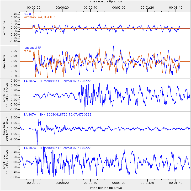
B07A Winthrop, WA, USA - Earthquake Result Viewer
*The percent match for this event was below the threshold and hence no stack was calculated.
| Earthquake location: |
Fiji Islands Region |
| Earthquake latitude/longitude: |
-17.3/-179.0 |
| Earthquake time(UTC): |
2008/04/18 (109) 20:39:07 GMT |
| Earthquake Depth: |
554 km |
| Earthquake Magnitude: |
5.9 MB, 6.3 MW, 6.3 MW |
| Earthquake Catalog/Contributor: |
WHDF/NEIC |
|
| Network: |
TA USArray Transportable Network (new EarthScope stations) |
| Station: |
B07A Winthrop, WA, USA |
| Lat/Lon: |
48.46 N/120.12 W |
| Elevation: |
781 m |
|
| Distance: |
83.8 deg |
| Az: |
34.979 deg |
| Baz: |
235.345 deg |
| Ray Param: |
$rayparam |
*The percent match for this event was below the threshold and hence was not used in the summary stack. |
|
| Radial Match: |
63.192646 % |
| Radial Bump: |
400 |
| Transverse Match: |
55.978283 % |
| Transverse Bump: |
400 |
| SOD ConfigId: |
2504 |
| Insert Time: |
2010-03-07 02:56:46.803 +0000 |
| GWidth: |
2.5 |
| Max Bumps: |
400 |
| Tol: |
0.001 |
|
Signal To Noise
| Channel | StoN | STA | LTA |
| TA:B07A: :BHN:20080418T20:50:07.475022Z | 6.342573 | 1.003027E-6 | 1.5814197E-7 |
| TA:B07A: :BHE:20080418T20:50:07.475022Z | 0.995598 | 1.5262822E-7 | 1.5330306E-7 |
| TA:B07A: :BHZ:20080418T20:50:07.475022Z | 3.1643379 | 2.1039092E-7 | 6.6488134E-8 |
| Arrivals |
| Ps | |
| PpPs | |
| PsPs/PpSs | |


