B04A Port Angeles, WA, USA - Earthquake Result Viewer
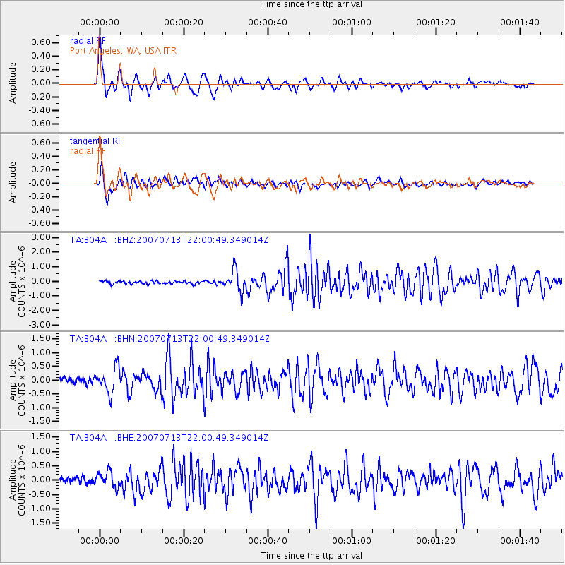
Earthquake location: Andreanof Islands, Aleutian Is.
Earthquake latitude/longitude: 51.8/-176.3
Earthquake time(UTC): 2007/07/13 (194) 21:54:43 GMT
Earthquake Depth: 35 km
Earthquake Magnitude: 5.7 MB, 5.6 MS, 6.0 MW, 5.9 MW
Earthquake Catalog/Contributor: WHDF/NEIC
Network: TA USArray Transportable Network (new EarthScope stations)
Station: B04A Port Angeles, WA, USA
Lat/Lon: 48.06 N/123.50 W
Elevation: 294 m
Distance: 33.6 deg
Az: 75.129 deg
Baz: 296.635 deg
Ray Param: 0.078096546
Estimated Moho Depth: 32.75 km
Estimated Crust Vp/Vs: 1.89
Assumed Crust Vp: 6.566 km/s
Estimated Crust Vs: 3.474 km/s
Estimated Crust Poisson's Ratio: 0.31
Radial Match: 88.829185 %
Radial Bump: 400
Transverse Match: 87.30457 %
Transverse Bump: 400
SOD ConfigId: 2564
Insert Time: 2010-03-07 03:10:51.498 +0000
GWidth: 2.5
Max Bumps: 400
Tol: 0.001

Signal To Noise

ChannelStoNSTALTA
TA:B04A: :BHN:20070713T22:00:49.349014Z3.62417364.4993743E-71.2414897E-7
TA:B04A: :BHE:20070713T22:00:49.349014Z2.86182672.7613592E-79.648939E-8
TA:B04A: :BHZ:20070713T22:00:49.349014Z8.4027977.3398166E-78.734968E-8
Arrivals
Ps4.8 SECOND
PpPs13 SECOND
PsPs/PpSs18 SECOND