
B04A Port Angeles, WA, USA - Earthquake Result Viewer
| ||||||||||||||||||
| ||||||||||||||||||
| ||||||||||||||||||
|
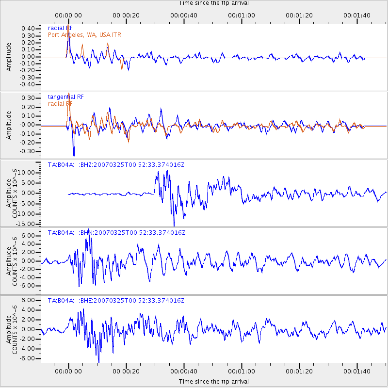
Signal To Noise
| Channel | StoN | STA | LTA |
| TA:B04A: :BHN:20070325T00:52:33.374016Z | 4.9933915 | 2.129426E-6 | 4.2644888E-7 |
| TA:B04A: :BHE:20070325T00:52:33.374016Z | 5.924398 | 1.8210982E-6 | 3.0738957E-7 |
| TA:B04A: :BHZ:20070325T00:52:33.374016Z | 19.434929 | 5.8999967E-6 | 3.0357697E-7 |
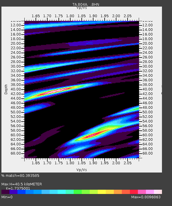
| Arrivals | |
| Ps | 4.7 SECOND |
| PpPs | 16 SECOND |
| PsPs/PpSs | 21 SECOND |

