You are here: Home > Network List > TA - USArray Transportable Network (new EarthScope stations) Stations List
> Station L22K Petersville, AK, USA > Earthquake Result Viewer
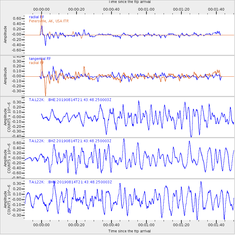
L22K Petersville, AK, USA - Earthquake Result Viewer
*The percent match for this event was below the threshold and hence no stack was calculated.
| Earthquake location: |
Revilla Gigedo Islands Region |
| Earthquake latitude/longitude: |
20.5/-109.2 |
| Earthquake time(UTC): |
2019/08/14 (226) 21:35:19 GMT |
| Earthquake Depth: |
10 km |
| Earthquake Magnitude: |
5.8 Mww |
| Earthquake Catalog/Contributor: |
NEIC PDE/us |
|
| Network: |
TA USArray Transportable Network (new EarthScope stations) |
| Station: |
L22K Petersville, AK, USA |
| Lat/Lon: |
62.53 N/150.77 W |
| Elevation: |
817 m |
|
| Distance: |
50.7 deg |
| Az: |
336.582 deg |
| Baz: |
126.537 deg |
| Ray Param: |
$rayparam |
*The percent match for this event was below the threshold and hence was not used in the summary stack. |
|
| Radial Match: |
70.90856 % |
| Radial Bump: |
400 |
| Transverse Match: |
63.43703 % |
| Transverse Bump: |
400 |
| SOD ConfigId: |
19053131 |
| Insert Time: |
2019-08-28 21:44:36.155 +0000 |
| GWidth: |
2.5 |
| Max Bumps: |
400 |
| Tol: |
0.001 |
|
Signal To Noise
| Channel | StoN | STA | LTA |
| TA:L22K: :BHZ:20190814T21:43:48.250003Z | 3.2112644 | 1.8102547E-7 | 5.6372023E-8 |
| TA:L22K: :BHN:20190814T21:43:48.250003Z | 1.2703791 | 1.1280649E-7 | 8.8797506E-8 |
| TA:L22K: :BHE:20190814T21:43:48.250003Z | 1.7788786 | 1.1999091E-7 | 6.745312E-8 |
| Arrivals |
| Ps | |
| PpPs | |
| PsPs/PpSs | |


