S14A Cedar City, UT, USA - Earthquake Result Viewer
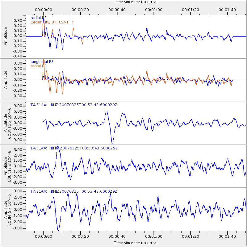
Earthquake location: Near West Coast Of Honshu, Japan
Earthquake latitude/longitude: 37.3/136.6
Earthquake time(UTC): 2007/03/25 (084) 00:41:57 GMT
Earthquake Depth: 8.0 km
Earthquake Magnitude: 6.1 MB, 6.8 MS, 6.7 MW, 6.6 MW
Earthquake Catalog/Contributor: WHDF/NEIC
Network: TA USArray Transportable Network (new EarthScope stations)
Station: S14A Cedar City, UT, USA
Lat/Lon: 37.76 N/113.17 W
Elevation: 1746 m
Distance: 81.4 deg
Az: 48.771 deg
Baz: 310.858 deg
Ray Param: 0.04762265
Estimated Moho Depth: 11.0 km
Estimated Crust Vp/Vs: 2.06
Assumed Crust Vp: 6.194 km/s
Estimated Crust Vs: 3.003 km/s
Estimated Crust Poisson's Ratio: 0.35
Radial Match: 81.33649 %
Radial Bump: 400
Transverse Match: 67.68781 %
Transverse Bump: 400
SOD ConfigId: 2564
Insert Time: 2010-03-07 03:19:37.432 +0000
GWidth: 2.5
Max Bumps: 400
Tol: 0.001

Signal To Noise

ChannelStoNSTALTA
TA:S14A: :BHN:20070325T00:53:43.600029Z1.99613969.4304835E-74.7243608E-7
TA:S14A: :BHE:20070325T00:53:43.600029Z1.03912456.652919E-76.402427E-7
TA:S14A: :BHZ:20070325T00:53:43.600029Z2.92886332.9974458E-61.0234161E-6
Arrivals
Ps1.9 SECOND
PpPs5.3 SECOND
PsPs/PpSs7.3 SECOND